Bridgnorth
On our travels
to or through the beautiful county of Shropshire we often skirted around
the edge of the historic market town of Bridgnorth, never quite having enough
time to visit. That’s because it is a town that is filled with sites to explore and things to do. There's the
Kings View, wonderful architecture, castle ruins, steam trains, a cliff railway,
riverside walks, and the lovely small alleyways and steps tying it all together. Bridgnorth holds enough interest for a short break or - at the least - a very long day out!
Divided by England's longest river, the River Severn, Bridgnorth is a town of two halves, High Town, the oldest part of Bridgnorth, sits atop the red sandstone cliffs around the early castles and forts. Low Town lies mostly on the opposite bank of the river, and is much younger in age.
The views from high and low are outstanding and Bridgnorth would make a really convenient base for a holiday. You will find plenty of other things to do in lovely Shropshire!
Exploring Bridgnorth Walking Map
Much of this walk is based on a leaflet I found on the visitbridgnorth.co.uk website. I’ve added a little extra so that we could see Daniel’s Mill and the views from High Rock. If you left these two points out the walk would be over four miles shorter!
Along the way you’ll also find plenty of other little things to see. Choose a nice dry day and you’ll have a fantastic day out discovering Bridgnorth.
If you’re a komoot.com user you should be able to follow my route on your mobile device, including voice instructions. If you require a gpx file, then use the “Discover more info about this tour” link to download the file for your GPS device.
Our start point was from the Old Smithfield car park along Old Smithfield between the Hospital and Sainsbury’s supermarket.
Cross the road and walk through Whitburn Street Car Park to an alleyway that joins Whitburn Street. Turn left and head towards the junction with High Street to find…
1. The Kings Head
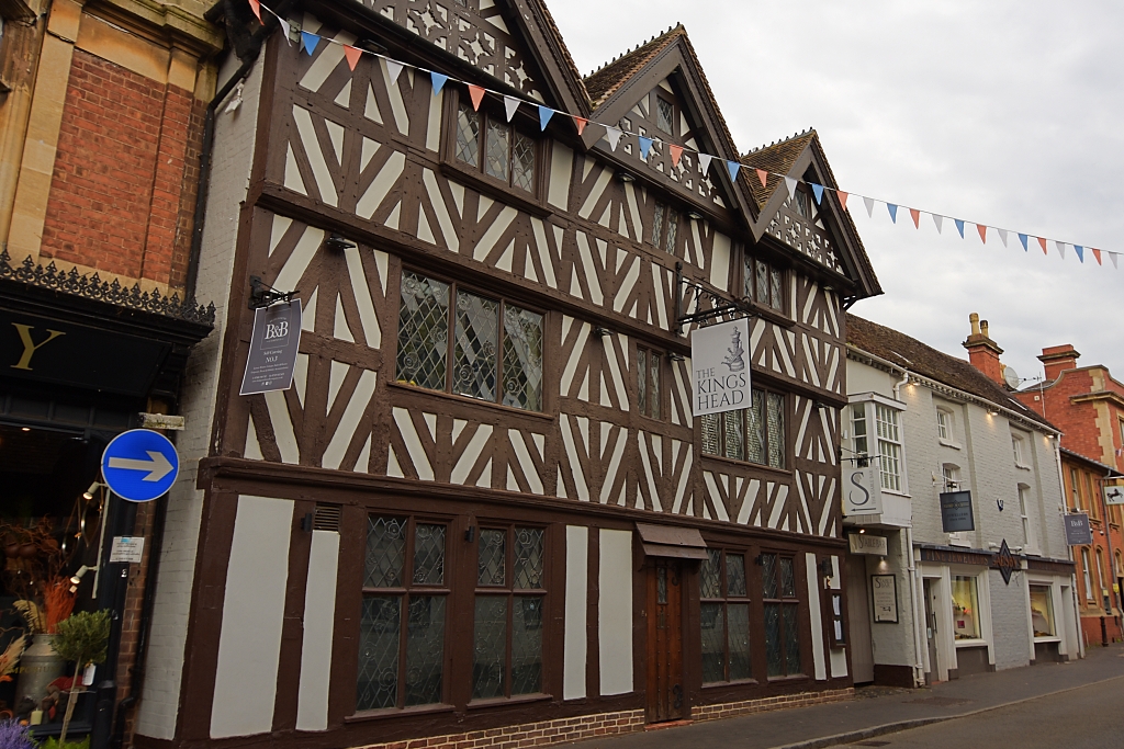 The Kings Head © essentially-england.com
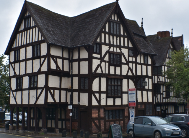
The Kings Head on Whitburn Street is a Grade II listed, timber-framed coaching inn from around 1650. It is believed the building was rebuilt from the ruins of an earlier building after parliamentarian forces bombarded the town in 1646. This lovely building is three storeys high, with three gables, and has beautiful black and white work. On the opposite side of the road is another pub called The Crown.
Continue to High Street and turn left to find Northgate in front of you.
2. Northgate
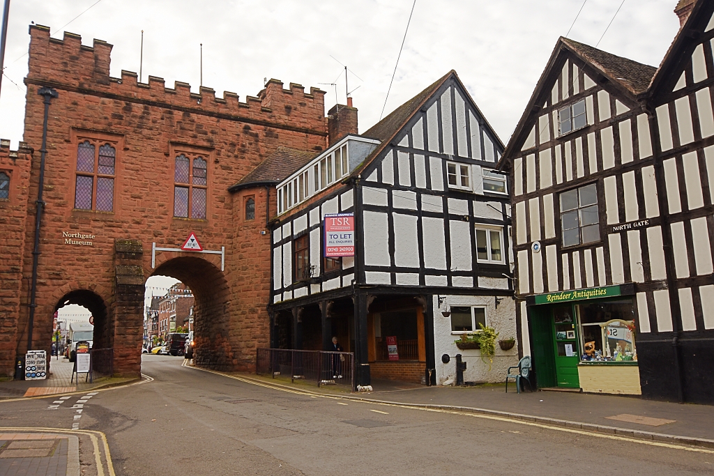 The North Gate © essentially-england.com
Northgate on High Street is the last remaining of the five gates that were part of the town’s fortifications. Originally constructed in 1265, the gate was rebuilt in 1740 to replace one of the town’s prisons with a meeting hall. It was fully restored in the early twentieth century and now holds the Northgate Museum. The adjacent timber-framed buildings are from the 17th century.
Retrace your steps back to the crossroads and turn left into Church Street.
3. Church Street and St. Leonard’s
Church
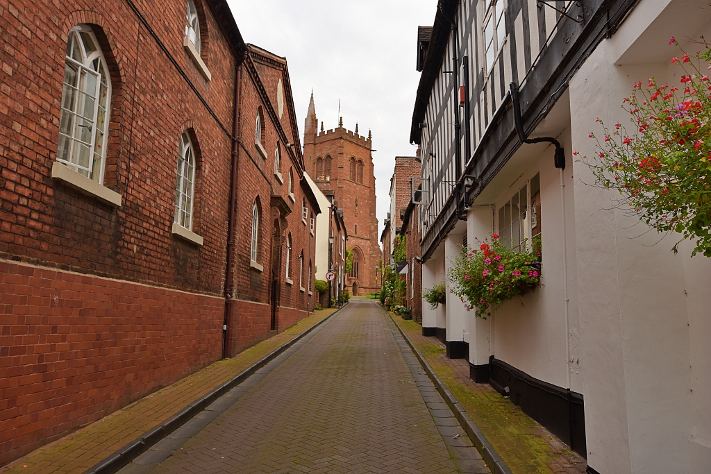 Church Street Almshouses and St. Leonard's Church
 © essentially-england.com
Along the left-hand side of Church Street, you can find a block of almshouses which were founded in 1503 and rebuilt in 1792. The slight incline of Church Street takes you to the highest point in Bridgnorth and the lovely, red sandstone edifice of St. Leonard’s Church. There’s been a church on this site from since Norman times, but the original church was destroyed during the Civil War when it was being used as an ammunition store by the Parliamentarian army and got hit by cannon fire. The current building is almost all Victorian.
The church is supposed to have a lovely interior, but unfortunately was not open when we visited. Turn left and wander around beautiful St. Leonard’s Close as it has some of the finest architecture in Bridgnorth. Including…
4. Richard Baxter’s House
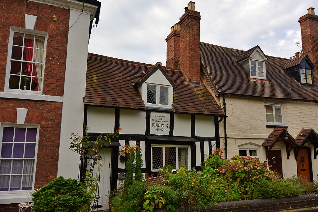 Richard Baxter's House © essentially-england.com
The well-known Puritan preacher and writer Richard Baxter lived in this small, black-and-white house between 1640 and 1641. He started his religious career as assistant priest of St. Leonard’s Church.
5. The Old Grammar School
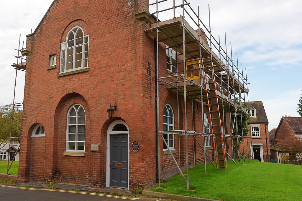 The Old Grammar School © essentially-england.com
Around 1500, a grammar school was established in the former chapel of St. John the Baptist Church. In 1503, the Bridgnorth Corporation started a second schoolhouse in St. Leonard’s Close. The school was restored in 1785 and continued to be run by the corporation until 1909.
In 1840, the cost of entrance was three guineas (£1:05p) and 40 guineas for board and tuition.
6. The Grammar Schoolhouse
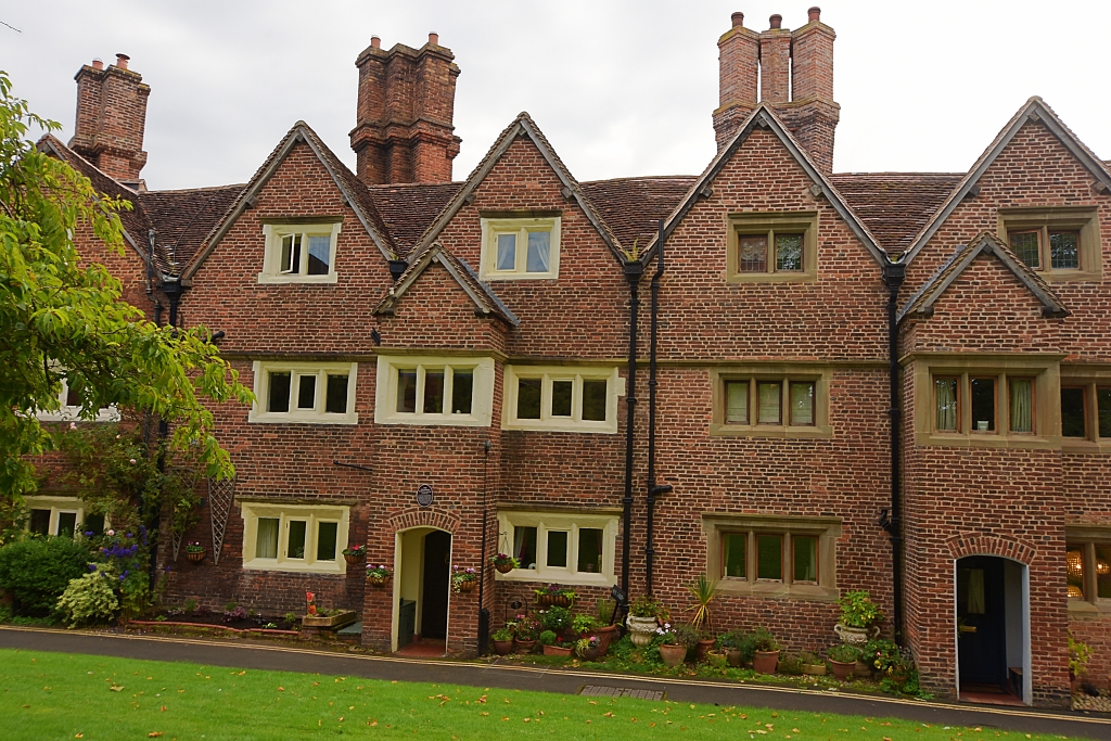 The Grammar Schoolhouse © essentially-england.com
The Grammar Schoolhouse is a brick-built terrace of houses dating from around 1630. Originally these wonderful buildings with their stone-mullioned windows and diagonally set chimneys would have held the schoolhouse where the tutor and borders lived and held classes, the headmasters house, and the rectory for the vicar of St. Leonard’s Church.
7. Palmer's Hospital
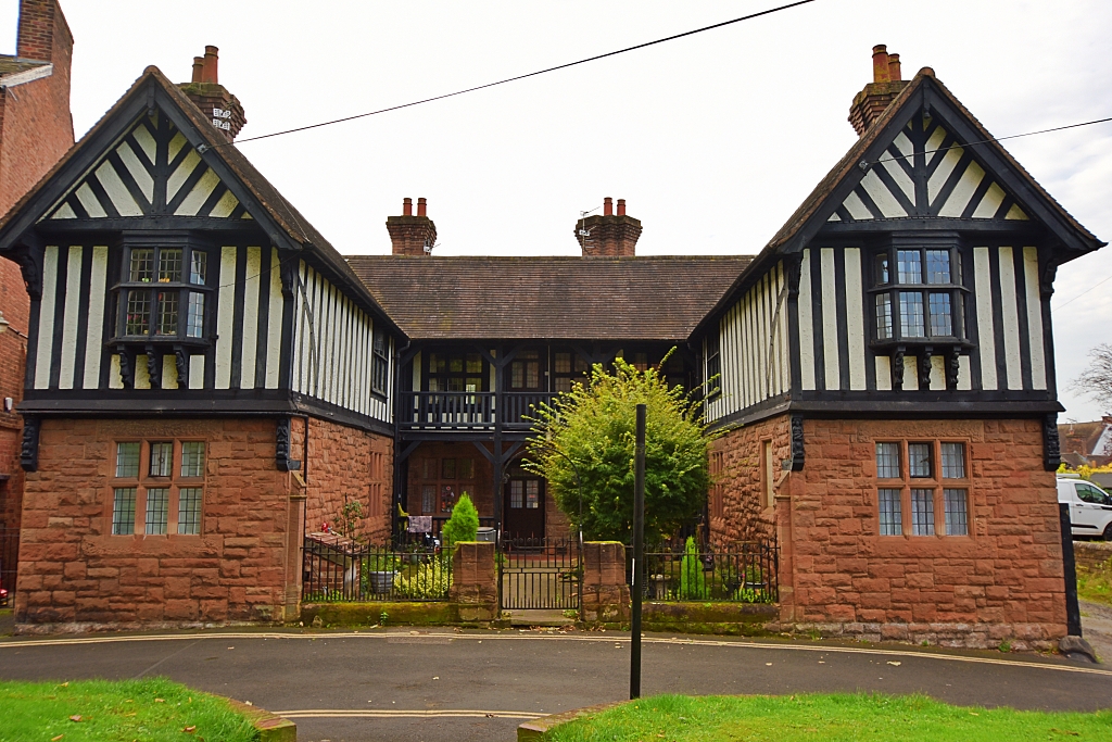 Palmer's Hospital © essentially-england.com
These almshouses for ten poor widows of upper town were gifted by Francis Palmer, a late rector of Sandy in Bedfordshire in 1687. The almshouses were rebuilt in 1889 with a lovely black and cream timber-framed upper floor sitting on a stone ground floor.
After circling the peaceful St. Leonard’s Close, backtrack slightly and descend St. Leonard’s Steps to come out through a brick archway at the junction of Friar’s Street and Cartway. Descend Cartway for about 20 metres and take Bank Steps on the left to join River Side. Turn left on River Side and walk beside the River Severn until you reach…
8. The Friary
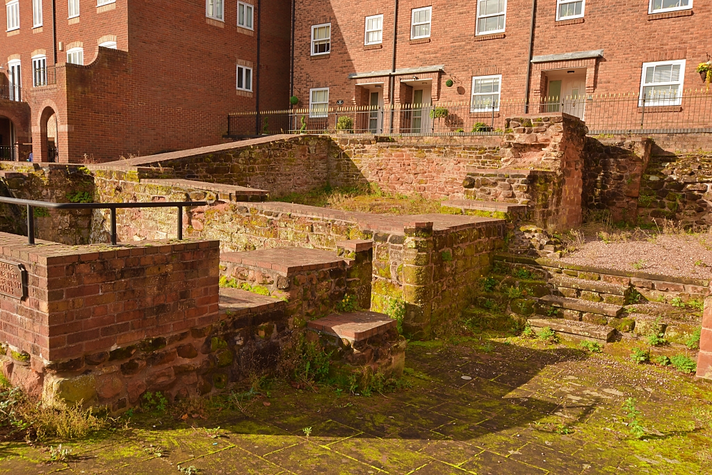 Medieval Franciscan Friary © essentially-england.com
The Friary was founded by the Franciscan Order between 1224 and 1244. Both King Henry III and King Edward I donated towards the costs of building and maintenance of the Friary, which survived until the Dissolution of the Monasteries in 1538.
Now retrace your steps and follow the riverbank until the junction with Cartway, where you’ll find…
9. Bishop Percy’s House
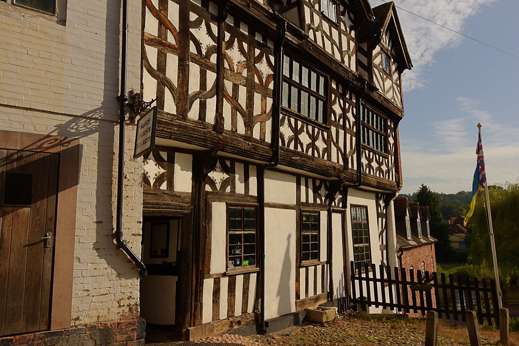 Bishop Percy's House © essentially-england.com
This Grade I listed house was built in 1580 by a wealthy barge owner and shipping merchant. It was built from oak posts and beams from old ships and wattle and daub panelling. The house is one of the few that survived the fire of Bridgnorth during the Civil War in 1646. The house takes its name from Thomas Percy who was born here in 1729 and went on to become Bishop of Dromore in Northern Ireland.
Bishop Percy’s House has now been tastefully converted into a Tearoom and holiday apartments.
Continue up Cartway.
10. Cartway
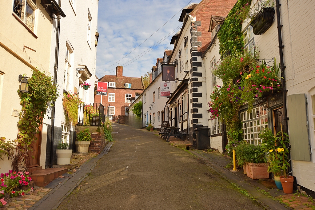 Cartway © essentially-england.com
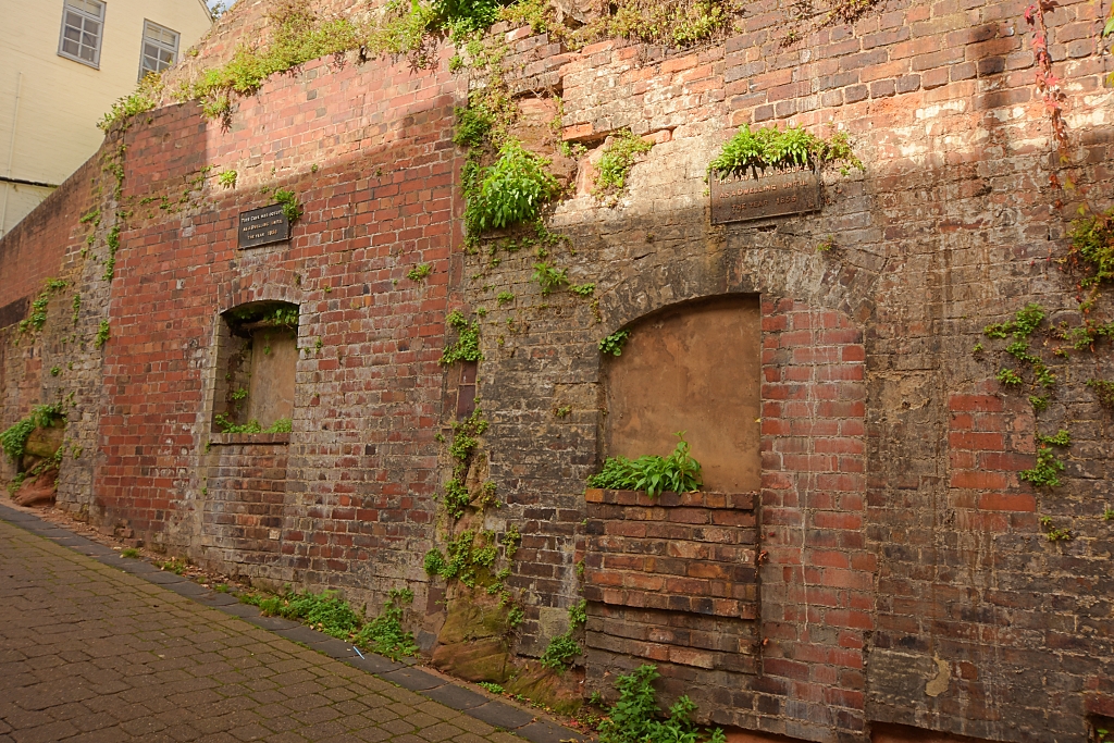 Former Cave Dwellings on Cartway © essentially-england.com
This beautiful narrow road was once the only way for wheeled transport travelling between Low Town and High Town. It still holds lots of pretty old buildings with colourful flower displays and even signs of some cave homes that were used until 1856.
At the top of Cartway turn right on to High Street which has several notable buildings including the iconic stilted Town Hall.
11. The Town Hall
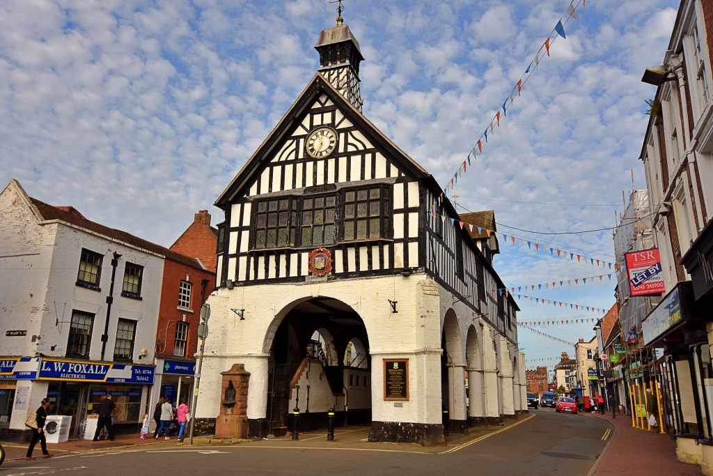 Bridgnorth Town Hall © essentially-england.com
The Town Hall was built just after the Civil War when much of Bridgnorth had been damaged by fire. It consists of a black and white timber-framed hall on top of an arched base made from sandstone. The building has been considerably altered over the years, including facing the red sandstone with brick and painting the brick black and white to match the hall.
Now walk down St. Mary's Street.
12. St. Mary's Street
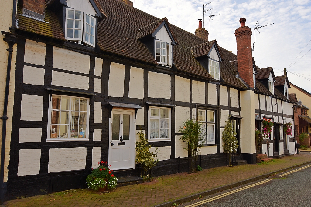 Timber Framed Houses on St. Mary's Street
 © essentially-england.com
As the new town of Bridgnorth developed away from the castle in the 12th century, St. Mary’s Street was one of three roads that ran parallel to one another off High Street. Many of the buildings along this street are timber-framed, though most have acquired brick facings. In medieval times, the buildings would have been narrow, and each with their own long plot of land for livestock, growing food, or workshops.
At the the end of St. Mary's Street at the roundabout, turn left onto Listley Street and follow to the crossroads with High Street, Cartway, and Postern Gate to view the...
13. New
Market Buildings
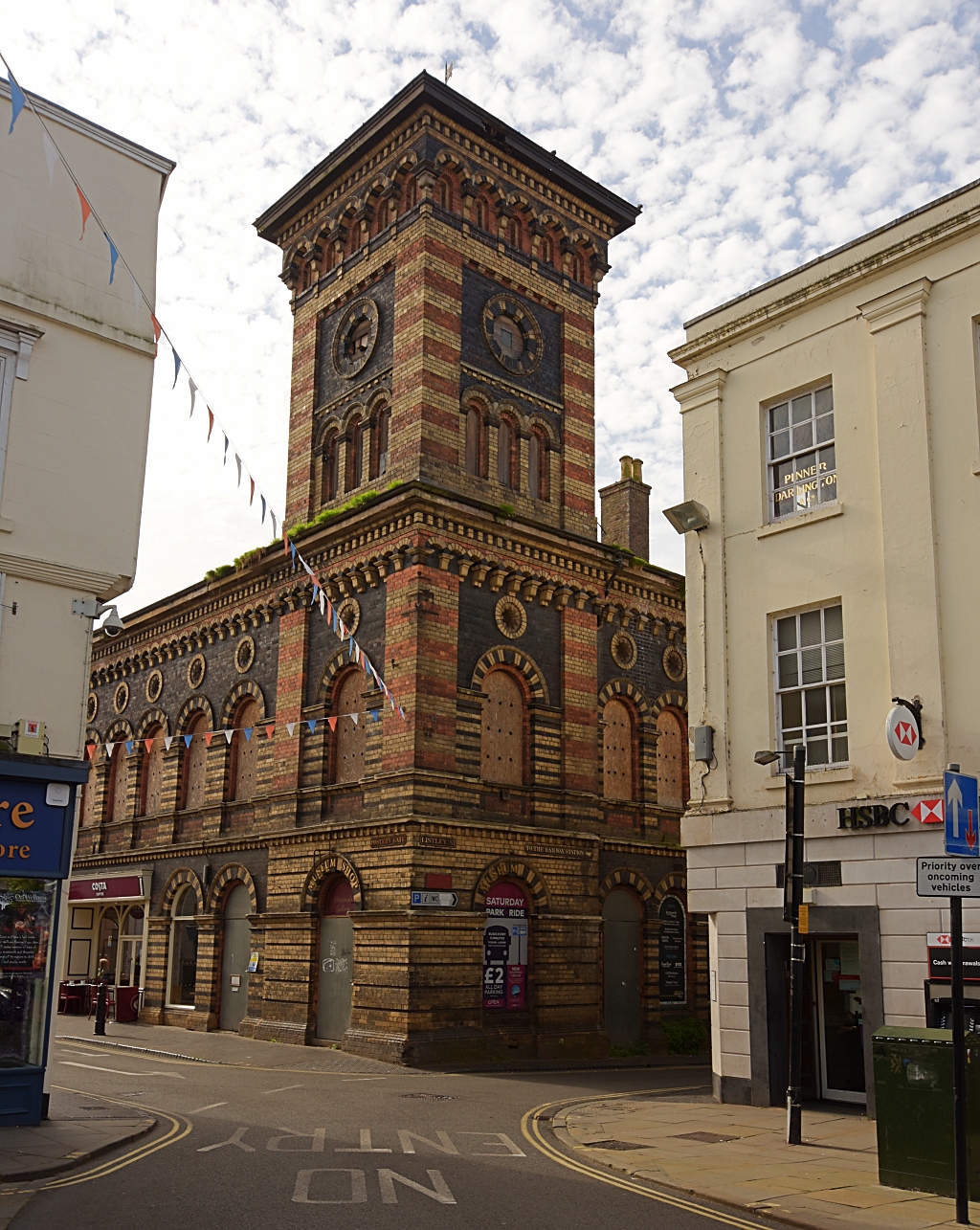 New Market Buildings © essentially-england.com
The striking Grade II listed New Market Buildings are from 1855 and were built as an indoor market and assembly rooms. However, the street market sellers refused their new home and won a legal case to remain on High Street.
Turn right onto Postern Gate and then quickly left to walk along Bank Street. At the end of the road turn right onto Castle Terrace to the Bridgnorth Cliff Railway.
This part of the walk and the railway were closed off when we visited, and we were diverted along East Castle Street to get to St. Mary’s Church (point 16).
14. Bridgnorth Cliff Railway
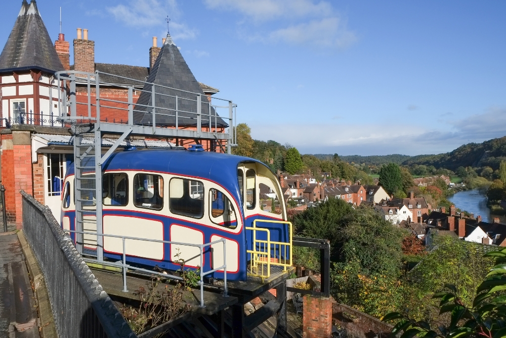 Bridgnorth Cliff Railway © clubphoto | Getty Images canva.com
The Bridgnorth Cliff Railway claims to be “England’s oldest and steepest inland electrical funicular railway”. It has been carrying passengers between Low Town and High Town for over one hundred years. Two carriages run on parallel tracks that are cut into the sandstone cliff face to negotiate the 111-feet height difference. Originally, the carriages operated on a water balance system but that was converted to electrical winding gear in the 1940s.
Continue onto…
15. Castle Walk
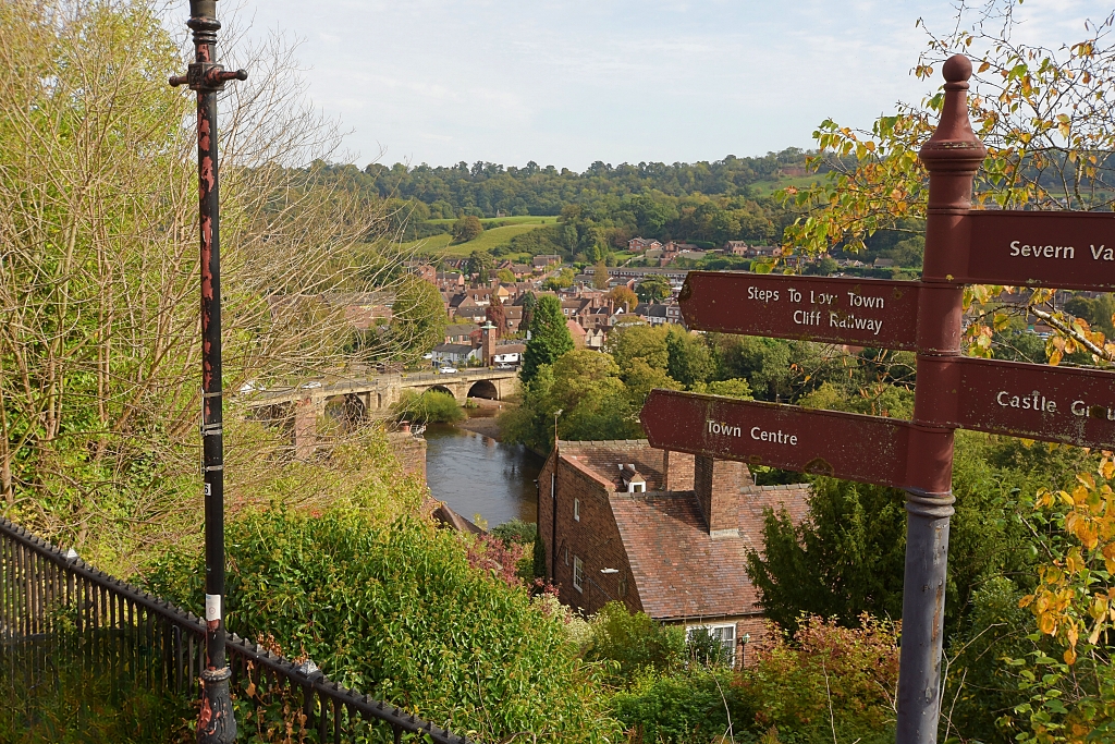 View from Castle Walk © essentially-england.com
Castle Walk follows the lines of the old castle’s battlements from Waterloo Terrace, near the top of Cartway, to Bridgnorth Castle and Gardens. There are fabulous views across the River Severn valley, and you can see why King Charles I declared that “the view was the finest in his dominion”.
Turn right to walk past…
16. St. Mary's Church
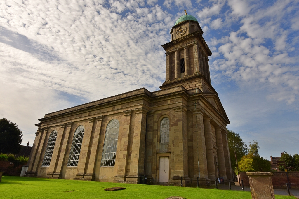 St. Mary's Church © essentially-england.com
St. Mary’s Church was the first church designed by engineer Thomas Telford whilst he was Shropshire’s county surveyor. It was built in the 1790s using a pale grey stone and has an unusual north – south alignment, with the altar in the south end and the tower to the north, to make it an imposing sight when approaching from along the very Georgian, East Castle Street.
Leave the church along the bricked path towards West Castle Street, making sure you look down the path on the left next to the first building as there is a great view of the castle remains. In a private parking area, turn left to enter the Castle Gardens.
17. The Castle and Castle Gardens
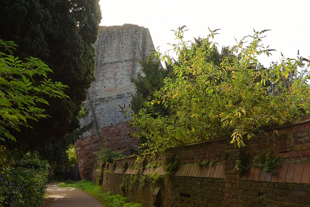 Bridgnorth Castle Keep Ruins © essentially-england.com
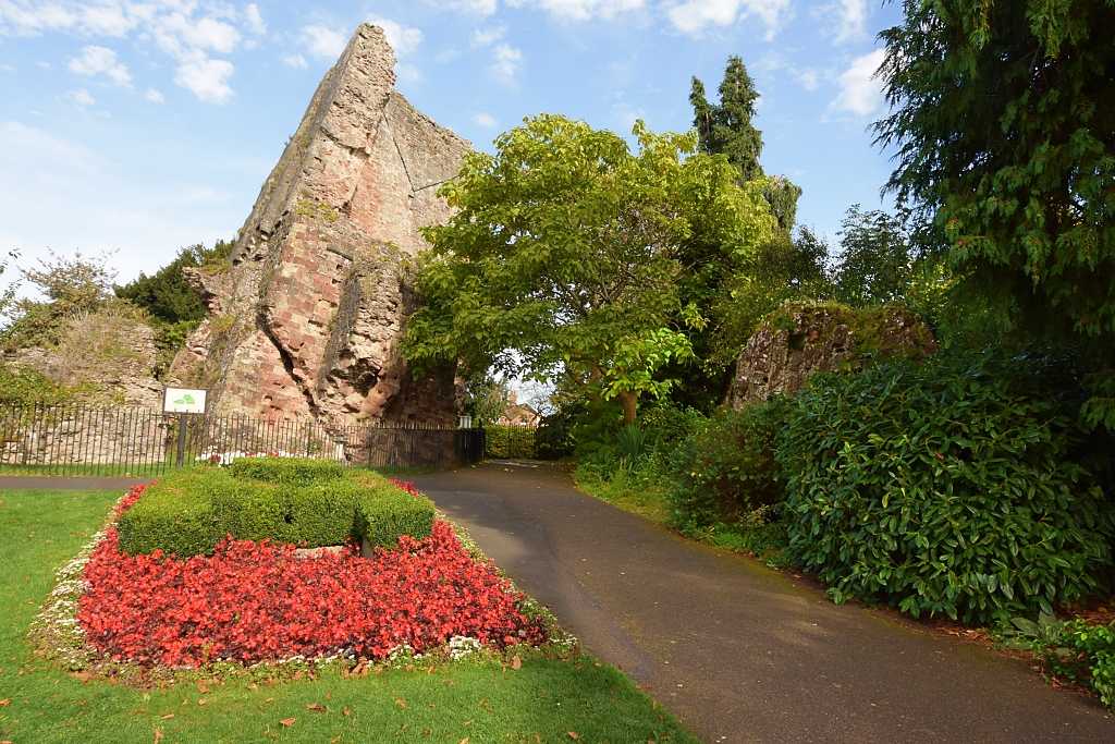 The Leaning Keep © essentially-england.com
What remains of Bridgnorth Castle can be found in the beautiful Castle Gardens which were opened to celebrate Queen Victoria’s Diamond Jubilee. All that’s left of the once impressive Norman castle that was established around 1100 by Robert de Belesme, Earl of Shrewsbury, is part of the great keep, and this rests at a perilous angle of 15 degrees. During the Civil War it was a Royalist stronghold and was besieged by the Parliamentarian army. After gaining control of the castle, the Parliamentarians used gunpowder to ensure it was never used again.
The triangular-shaped public garden contains colourful flower beds, topiaries cut to resemble military war machines, a bandstand, a statue of Sabrina who is Goddess of the River Severn, a Grade II listed war memorial, and an outstanding viewpoint looking out over the river.
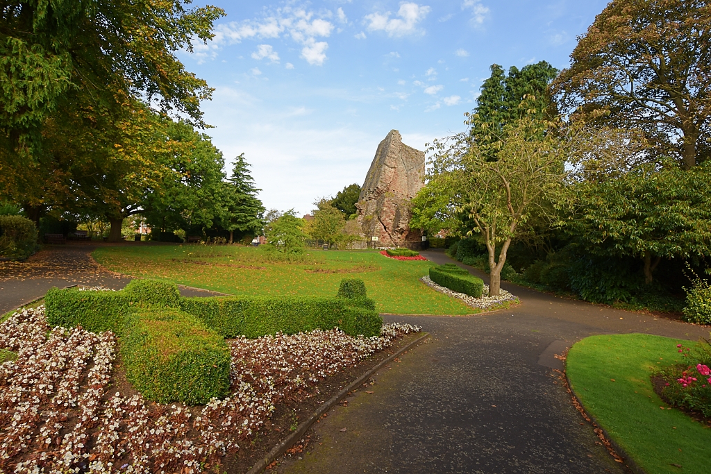 Castle Gardens © essentially-england.com
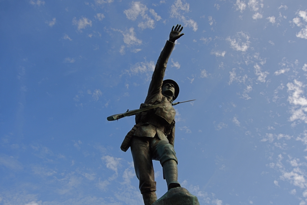 The War Memorial © essentially-england.com
Leave Castle Gardens by taking the path away from the bandstand to join Castle Walk. Descend Canon Steps which are almost opposite to New Road. Carefully cross the road and walk over the footbridge to Bridgnorth Station on the Severn Valley Railway. There are great views from the bridge including Panpudding Hill, just behind the station, which was an iron age hill fort, and the place Cromwell positioned his cannons to attack the castle in 1646!
18. Severn Valley Railway
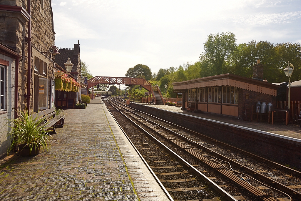 Bridgnorth Station © essentially-england.com
The Shrewsbury to Hartlebury railway line began operating in 1862 after taking nine years to build. The line was laid as a single track to try and save money and only ever served local passengers and goods transport, including moving coal from local mines to power stations. The line was closed in 1963, and within two years plans were in place to bring the railway back to life. In 1966, British Rail agreed to sell the line to the Severn Valley Railway Society, and the first steam locomotive arrived in 1967.
The heritage railway line operates on part of the original line with journeys taking just over an hour between Bridgnorth and Kidderminster. For more information on timetables and opening days please visit the Severn Valley Railway website.
Retrace your steps back over the bridge, up Cannon Steps and turn right onto Castle Walk. Continue along Castle Walk to turn right and descend Library Steps to Underhill Street. Turn left on Underhill Street to Lavington’s Hole.
19. Lavington's Hole
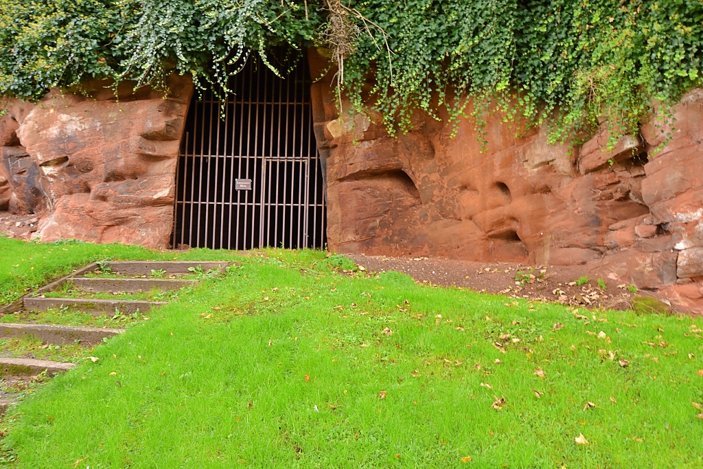 Lavington's Hole © essentially-england.com
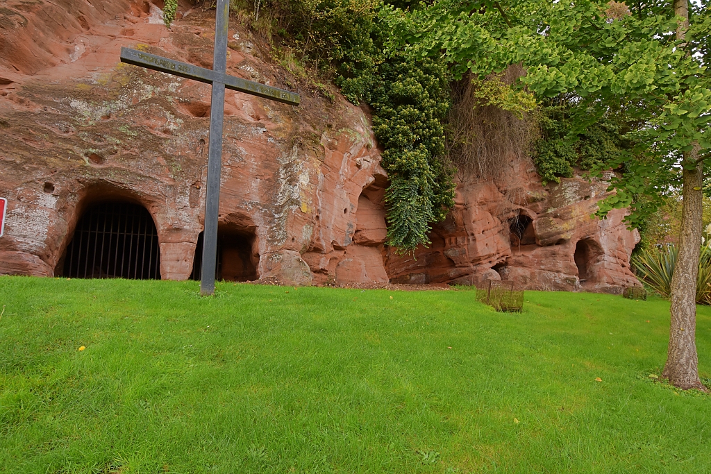 Sandstone Caves © essentially-england.com
The Parliamentarian attack on Bridgnorth in 1646 drove the Royalists to shelter in the castle. For weeks, cannon fire from Panpudding Hill bombarded the town, but neither the town nor the castle would yield.
Eventually, Colonel Lavington, an engineer in the Parliamentarian army, suggested digging a tunnel into the sandstone cliff below the castle and up towards St. Mary’s Church which stored the castles munitions. The noise and activity at the base of Castle Cliff made the Royalists worry about the cliff collapsing and killing thousands of people. By the time they surrendered the castle, the tunnel was seventy feet long.
Also, found at Lavington’s Hole are other manmade caves possibly used for storage and a Royal Airforce memorial garden.
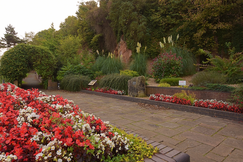 RAF Memorial near Lavington's Hole © essentially-england
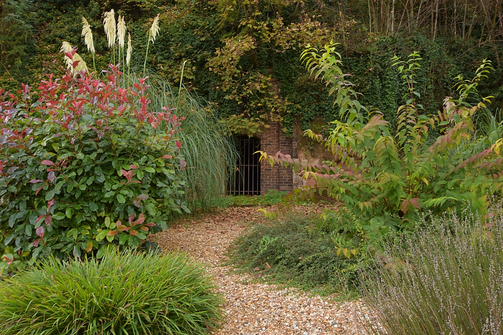 Lavington's Hole Garden © essentially-england.com
After exploring the caves and gardens at Lavington’s Hole, it’s time to leave town for a short while and stretch your legs with a lovely walk beside the River Severn. Carefully cross the road and walk back towards Library Steps. Turn left on to a footpath between two brick buildings, one being the Regency House Dental Practice, and follow to the bank of the River Severn. Turn right on the riverbank footpath and continue for about three quarters of a mile until it joins the B4555 road. The riverside footpath passes fields, goes under the main A458 road, and through woodland. Cross the road and walk up the drive to Daniel’s Mill.
The walk can be shortened at this point by not visiting Daniel’s Mill. Continue past Lavington Hole and rejoin the route at the Quayside (point 21).
20. Daniels Mill
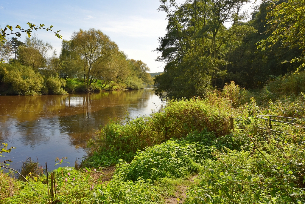 Riverside Path to Daniels Mill © essentially-england.com
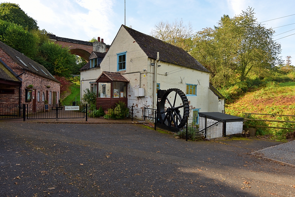 Daniels Mill and Railway Viaduct © essentially-england.com
There has been a watermill on this site for centuries and it may have also been the site of the mill listed in Eardington in the Domesday Book. Daniel’s Mill is the last traditional working water mill left in Shropshire and its near 39 feet diameter cast iron water wheel is the largest in England that drives a corn mill. The iron wheel and gearing were all made at the famous Coalbrookdale ironworks and shipped along the River Severn when the mill was refurbished in 1853.
The viaduct behind the mill was built when the railway came to Bridgnorth in the late 1850’s. It’s now part of the heritage Severn Valley Railway that runs between Bridgnorth and Kidderminster. If you’re lucky you may get to see steam trains crossing on operational days.
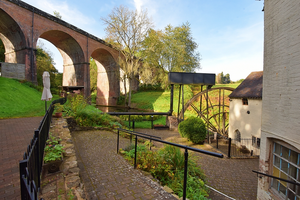 Railway Viaduct at Daniels Mill © essentially-england.com
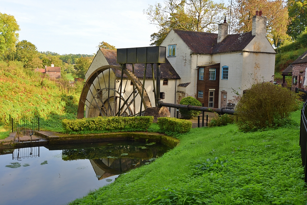 Daniels Mill near Bridgnorth © essentially-england.com
The route returns to Bridgnorth using the same riverside path and continues past the junction at which we joined the colourful old Quayside. Don't miss the great views of the river and bridge.
21. The Quayside and Bridge
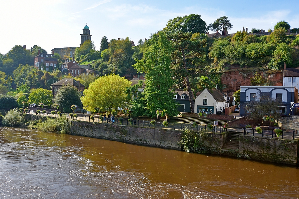 The Quayside © essentially-england.com
Throughout history, the River Severn was a major transport link between Shropshire and Bristol, Gloucester, and Monmouthshire in the southwest. Boats and barges carried tons of goods up and down the river. Sails aided the vessels going downstream, while horses or men called bow haulers pulled the boats upstream. Ironware, coal, wood, pottery, dairy products, and leather were shipped downstream and imported goods, groceries, spices, wine, and rum were bought north until the river trade fell into decline after the opening of the Severn Valley Railway.
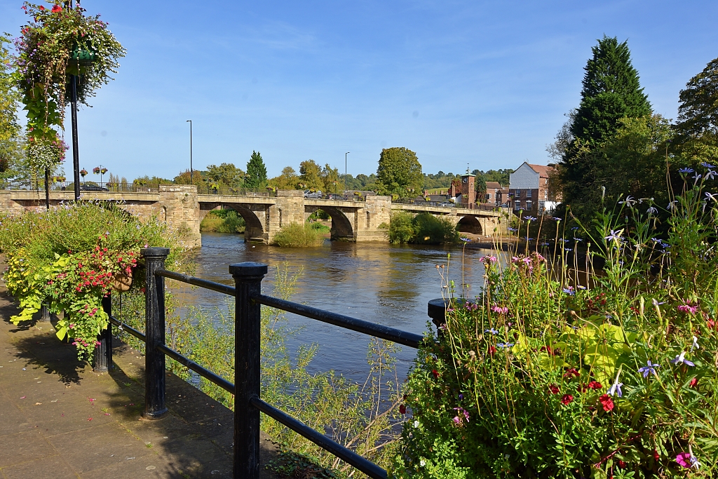 View from The Quayside © essentially-england.com
There was a bridge in Bridgnorth as far back as the tenth century. The current bridge dates from around 1820, when Thomas Telford widened a stone bridge, and in doing so removed several houses, a church and gatehouse that stood on the bridge.
From the Quayside you can walk up to High Rock or cross the road and make your way back up to High Town using the Stoneway Steps or Cliff Railway (see 23 below).
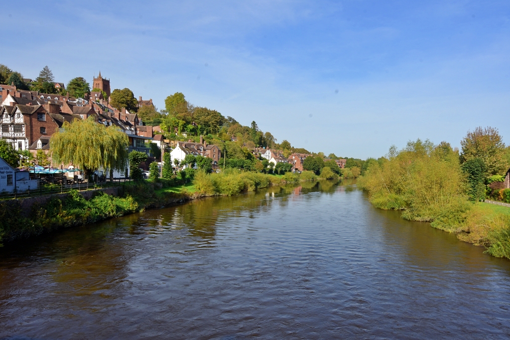 The River Severn Flowing Through Bridgnorth © essentially-england.com
The leg of
the route up to High Rock takes in the fantastic views of the River
Severn flowing through the centre of Bridgnorth. As I was planning the route, I
made this more of a circuit than was really necessary because I hoped for fine views along the edge back to High Rock. What we found were fields
thick with crops and no marked footpath and footpaths overgrown with brambles
and stinging nettles. The trail along the edge to High Rock had no views because
of the trees and we had to climb over and around fallen trees. With hindsight, I’d
probably just walk up and down using the same route which would shorten the total
walk.
Cross the River Severn, making sure that you look back at the views of the river and High Town. At the small clock tower, turn left and join the riverside path to Severn Park where there’s the chance of some good wildlife spotting. On the way to the park is a memorial garden where Hazeldine’s Foundry once stood and where the world’s first steam locomotive to pull fare-paying passengers was built in 1808.
In the park, turn right on to the main path that heads past the carpark and play area to the A422 road. Turn left and walk along the road until a right hand turn up to the cemetery. Climb up to the pretty cemetery gates and join the signposted footpath on the left in front of the gates. The climb is quite steep and could be slippery after wet weather.
The footpath enters woodland and the paths become smaller and more frequent. This is where we really appreciated the Komoot mapping function on my phone as it gave us the confidence to find the correct route through the trees and onto flatter farmland. Here, though, we couldn’t take the footpath across the fields as crops were still planted, so we walked around the boundary and found a metal gate to get out and on to a road towards the small hamlet of Bromley.
We rejoined our planned route near Woodside Farm and turned left onto a signposted footpath by a small triangular green. The footpath starts off okay, but after passing through a couple of farm gates it became quite overgrown. As the path enters the trees it turns sharp left to wind its way along the ridge. This part was quite tricky, and we had to climb over or around several fallen trees.
22. High Rock
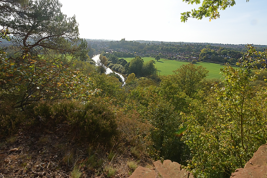 The view back to Bridgnorth from High Rock © essentially-england.com
However, the effort of climbing up to High Rock to take in the fantastic scene was well worth it. Unfortunately, my photos do not do the stunning views justice as the conditions were too hazy and I wasn’t brave enough to get right to the edge to get a clear view through the trees. Well, that’s my excuse!
We had a little trouble finding the correct path away from High Rock, but luckily our guidance systems quickly got us back on to the well-worn track that took us back to the footpath and down beside the cemetery. From the cemetery we retraced our steps through Severn Park, along side the River Severn, to cross over the bridge and start the climb back up to High Town.
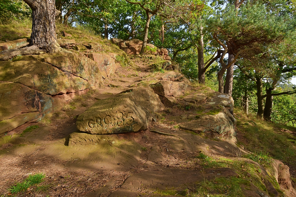 High Rock Above Bridgnorth © essentially-england.com
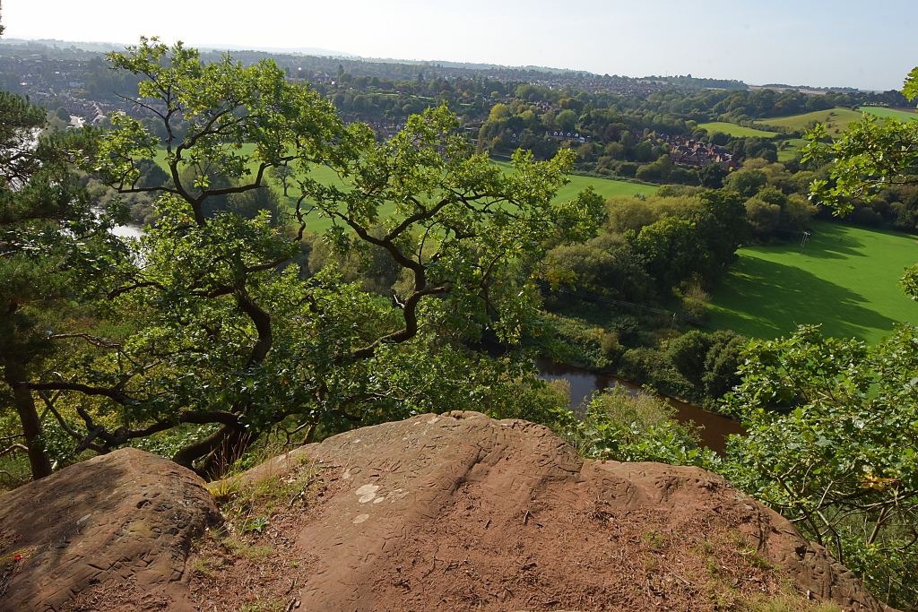 View from High Rock © essentially-england.com
The final push of our walk was to climb the Stoneway Steps which start after passing under the Cliff Railway arch. Although quite steep in places, much of the climb was between red sandstone walls with mosses, lichens, and ferns growing. It really was very pretty. The steps go past the Low Town entrance of the Cliff Railway if required!
23. Theatre on the Steps
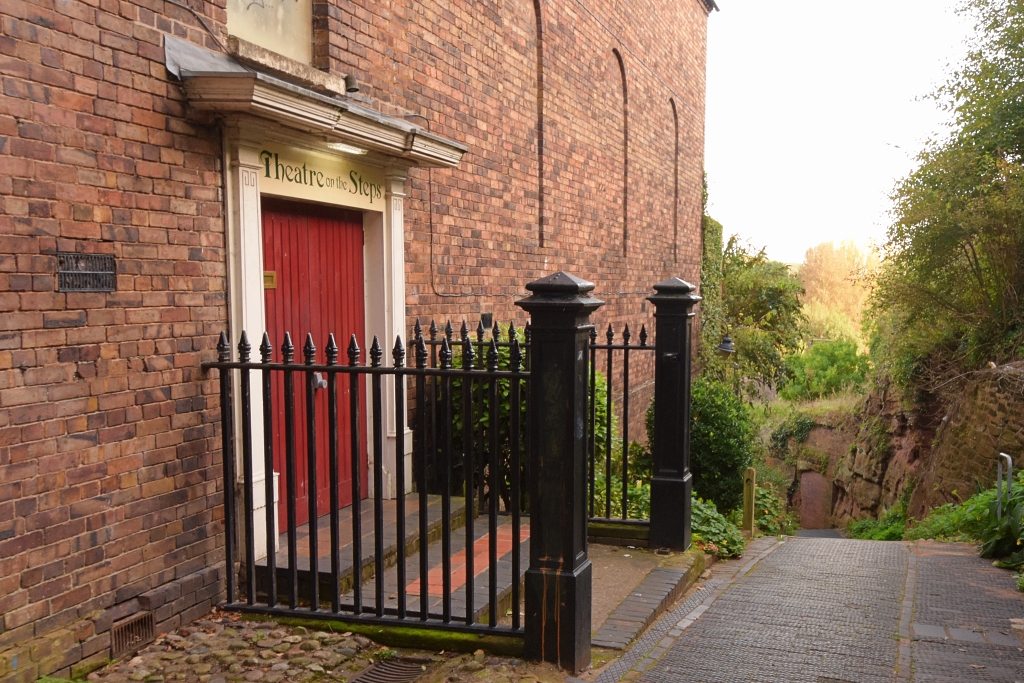 Theatre on the Steps © essentially-england.com
Halfway up Stoneway Steps is the Theatre on the Steps. This former Congregational Chapel was built in 1709 and closed in 1962 when three chapels merged as the United Reform Church and started to worship in the chapel near the top of Cartway. During the 1960s, the chapel on Stoneway Steps became a theatre. Converting it must have been quite a task as all the materials removed and brought to the theatre had to come up or down the steps!
The popular amateur theatre group runs shows throughout the year.
At the top of the steps is Waterloo Terrace, from where we retraced our steps along Cartway and the High Street back to the car park.
And were we pleased to be back at the car. Due to route changes and diversions, we ended up walking closer to ten miles on what was a very enjoyable, but warm October day. We loved Bridgnorth, it made such a great day out and I’m sure we’ll be going back one day to ride on the Cliff Railway and Severn Valley Railway, and to see the Hermitage Caves, and ringworks on Panpudding Hill.
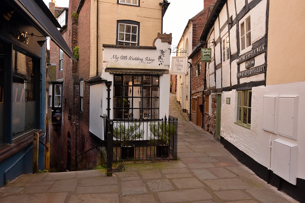 Waterloo Terrace © essentially-england.com
Are You Planning a Trip to Shropshire?
Shropshire is a marvellous place for history and food lovers! There's so much to see and do and taste, that you'll need more than just a short visit. If food is your thing, head to Ludlow and start exploring from there. For history lovers, Shrewsbury makes a great base with many historical sites in very easy reach.
Where You Could Stay
To see more self-catering cottages in Shropshire click here or check out holiday cottages in other parts of England by clicking here.
If you need to find a hotel, then try one of these search platforms...
What You Could See and Do
Here are a few places that should go on your must-see list:
- Wroxeter Roman City
- Shrewsbury Abbey
- Shrewsbury
- Attingham Hall and Parkland
- Cantlop Bridge
- Snailbeach Mine
- Much Wenlock
- Offa's Dyke
- Ironbridge Gorge, The Iron Bridge & Broseley Jitties
- Ludlow Castle
- Stokesay Castle
- Bridgnorth
Click here for a great list of things to do in Shropshire.
If you have enjoyed exploring Bridgnorth with us and are looking for other ideas for days out, then please click here to explore our Shropshire page.
