The Norwich 12
A Walking
Tour Exploring Norwich's Historic Sites
Norwich is a vibrant city and considered the capital of East Anglia. Back in medieval times, Norwich had even more going for it. The city was busy, wealthy, populous... and the second-biggest population centre after London. Given Norwich's long history, it's no wonder that the Norwich Heritage Economic and Regeneration Trust created the Norwich 12 - a heritage attraction consisting of a group of iconic buildings that demonstrate how English architecture has changed over the last 900 years.
If you're a history or architecture fan, then why not join us on this walk around the Norwich 12?
Our walk describes a detailed route around the Norwich 12 and many other historic buildings and streets. We hope you will find there is a certain charm about the medieval cobbled streets, alleys, and lanes.
The Norwich 12 buildings in the order our walk takes are: -
St James Mill
The Great Hospital
Norwich Cathedral
The Halls
Cathedral of St. John the Baptist
The Forum
The Assembly House
The City Hall
Norwich Guildhall
Norwich Castle
Surrey House
Dragon Hall
This circular walk is about 4.9 miles long, with an extension of 1.7 miles, if seeing parts of the old city wall are of interest. The walk includes the peace and vistas from riverside paths and the varied architecture and history of buildings that are up to almost 900 years old. As most of the walk is in the city centre there are many places to find food and drink.
Koomot.com users will be able to follow the route on their phones. If you use a GPS device and need a gpx file, then click the "Discover more info about this tour" link to download the file.
Let’s go…
Our Norwich 12 Walking Map
The starting point of our Norwich 12 walk is Norwich train station, as this is where we arrived for our visit to Norwich. From the station, head towards the road bridge crossing the River Wensum. Cross the bridge, and just before the Complete Angler pub, turn right onto the riverside footpath. We follow the path with the river on our right-hand side to Pull’s Ferry, one of Norwich’s less known historic sites.
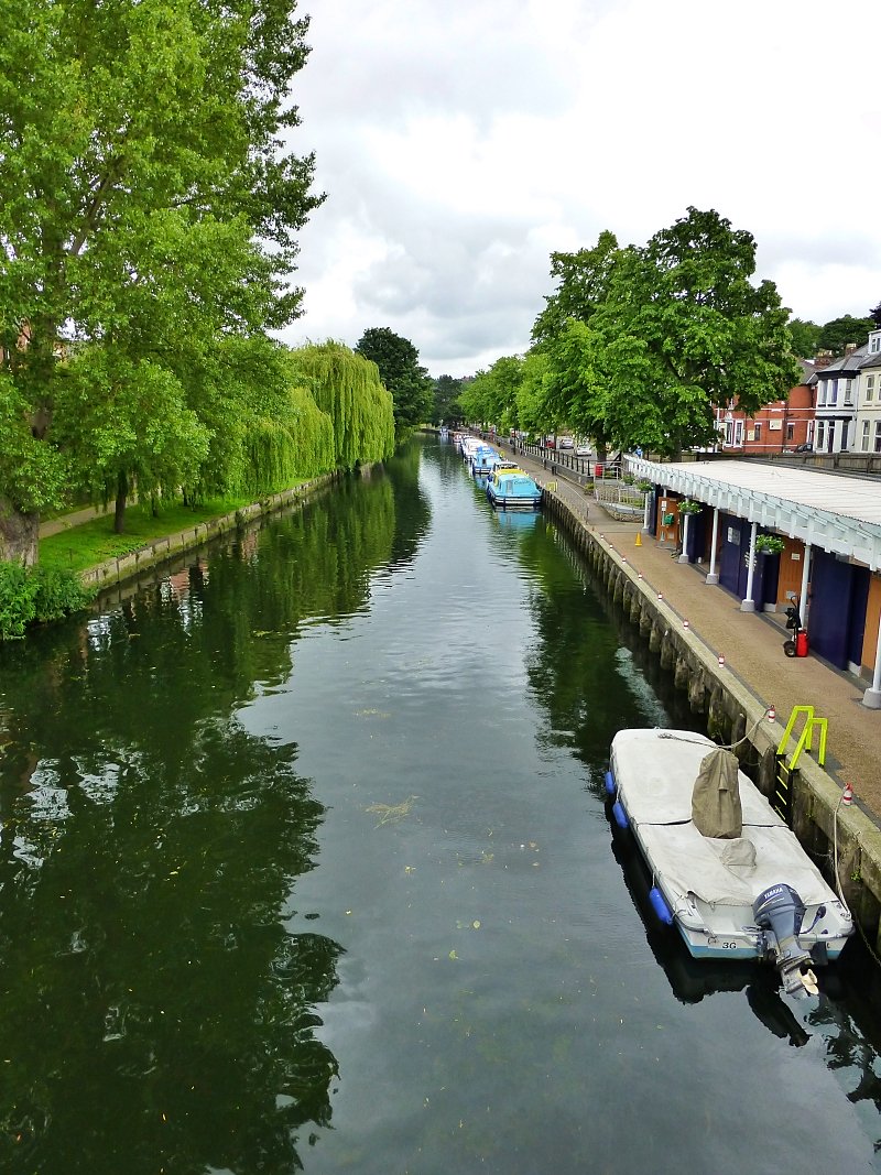 River Wensum in Norwich © essentially-england.com
Pull’s Ferry is a picturesque fifteenth century watergate that crossed a canal which was dug in the eleventh century to move the building materials from the river to the cathedral. The watergate protected the approach to the priory and cathedral, and when the priory was dissolved in the sixteenth century, it was extended into a house and inn. Not much of the canal exists now, as most of it was filled in and built upon from 1772. The unusual name given to the watergate originates from John Pull, who was the publican and ferryman between 1796 and 1841.
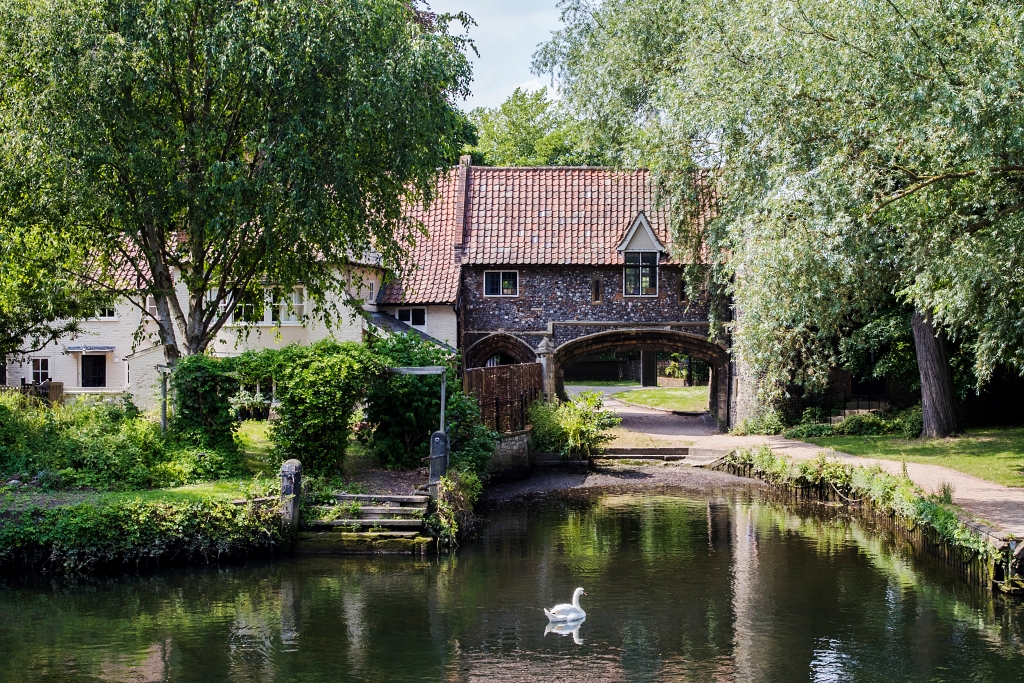 Pulls Ferry © Daisy-daisy | depositphotos.com
The walk continues alongside the river to Bishops Bridge, which dates to 1340. This rather grand stone and flint bridge used to have a gate house where you paid your toll to cross.
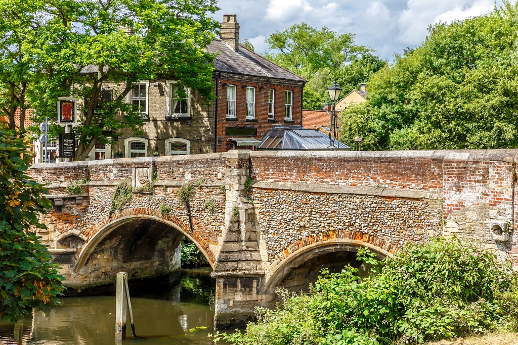 Bishops Bridge © Oscar Porras | depositphotos.com
By the Red Lion pub, follow the direction of the brown signpost to re-join the riverside to Cow Tower.
Cow Tower is a military tower, built around 1400 to defend the north-eastern approach into Norwich. This impressive standalone tower is 48 feet tall and 36 feet in diameter, and the walls have a maximum thickness of six feet. Initially, it would have been used by archers, but later by bombards, which were very early gunpowder weapons like canons.
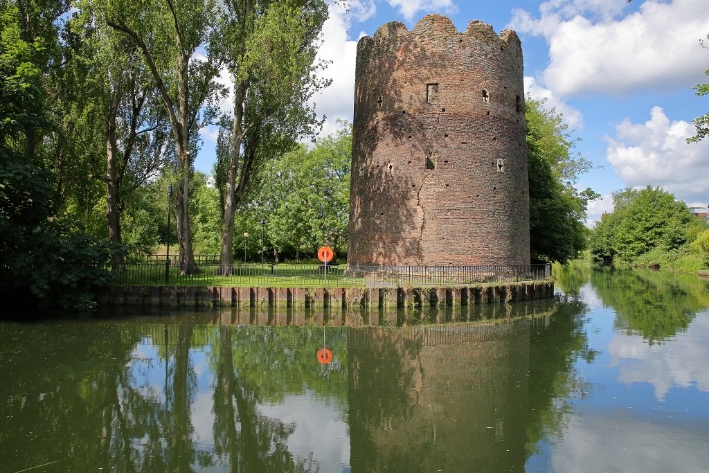 Cow Tower © Christophe Capelli | depositphotos.com
Leaving Cow Tower, the walk continues along the riverside, eventually passing the Crown, County, and Magistrates Courts to join the road at Whitefriars Bridge. As you walk by the courts, and before reaching the bridge, there are fines views across the river to the St. James Mill building, which is the first of the Norwich 12 on this walk.
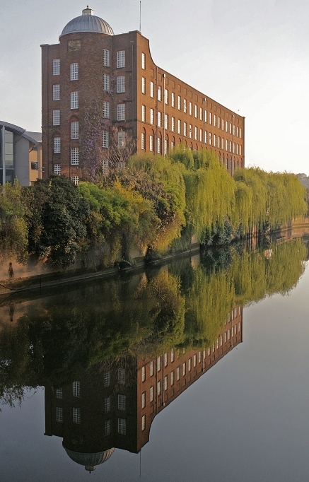 St James Mill
 © phountains_photography | Getty Images canva.com
The St. James Mill is a youngster compared to other buildings visited on this walk, but it's a good representation of Norwich during the Industrial Revolution. It was completed in 1839 for the Norwich Yarn Company, who were trying to rescue the declining local textile trade. The plan failed, and in 1902 the building was bought by Jarrold & Sons printing company, and then leased to Caley’s for chocolate making. In 1920, it became a government owned training centre for war veterans. By 1933 Jarrolds had repurchased the building, and it is still in use now as an office facility.
There is a little more history to this site.
Back in the thirteenth century, this plot of land belonged to a White Friar community (hence the name of the bridge!). It is still possible to see an arch and the undercroft from their original buildings.
Returning to the walk, you now need to make a choice. If you would like to see four small sections of the Norwich city wall then you need to turn right, cross Whitefriars Bridge, and follow the extension map below. This will add another 1.8 miles to the walk and is mostly walking through housing estates. The four bits of the old city wall are Barre Gate, Magdalen Gate, Augustine’s Gate, and St. Martin’s Gate.
You could also turn right and cross the river if you would like a closer look at St. James Mill.
Otherwise, we turn left and do not cross over the river on Whitefriars Bridge, as the walk now heads off to the Cathedral quarter.
At St. Martin-At-Place church we turn left in St. Martin-At-Place Plain. On the right are the private grounds of The Bishops House. Follow this road until it turns sharp right into Bishopgate, and as the road takes a sharp left, ignore the Cathedral entrance for a moment and continue to The Great Hospital, which is the second of our Norwich 12.
Founded in 1249 by Bishop de Suffield, The Great Hospital was initially for the benefit of poorly and aged priests, and, after over 750 years of continued use is still caring for people. The manicured six-acre site includes many fine buildings from the medieval to Victorian period and has detailed documents recording the hospitals history and development. Some of the historic building of interest include St. Helens church with one of the smallest monastic cloisters in England, a medieval refectory, almshouses, an eighteenth century swan pit, and the Birkbeck Hall.
Let’s retrace our steps back to the entrance to the cathedral grounds and follow the signs down The Close to the cathedral's entrance. This is number 3 of our Norwich 12.
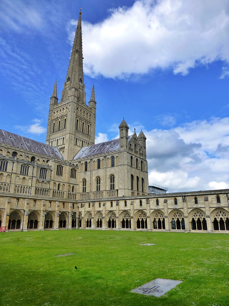 Norwich Cathedral
 © essentially-england.com
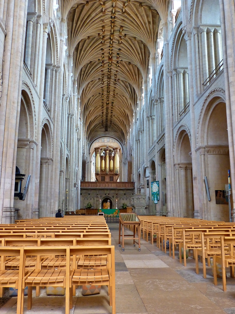 Interior of Norwich Cathedral
 © essentially-england.com
Using Caen stone from Normandy, and taking almost 50 years to build, Norwich Cathedral is one of the finest Norman cathedrals in Europe. Completed in 1145, it boasts the second-tallest spire in England and the largest cloister. How strange that we have the largest and almost smallest cloisters in England so close together!
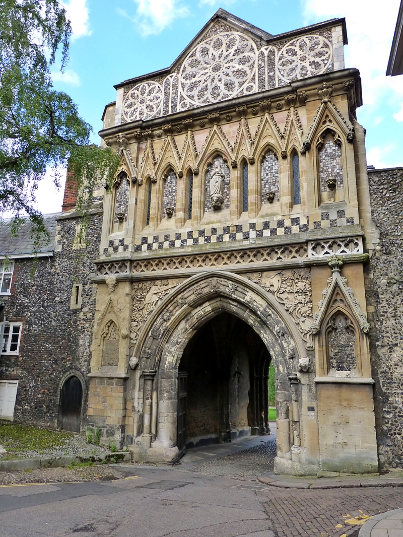 The Ethelbert Gate © essentially-england.com
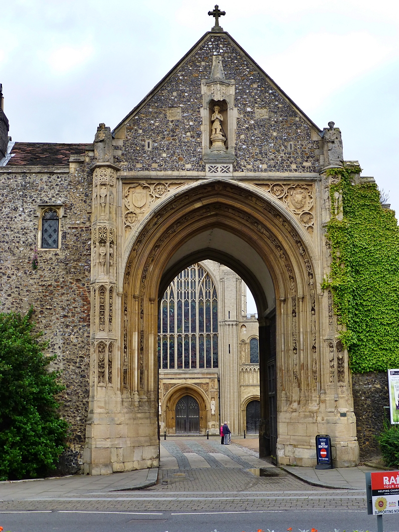 The Erpingham Gate © essentially-england.com
Return to The Close and leave the cathedral ground by the stunning Ethelbert Gate on to Queens Street. Turn right and follow Tombland and shortly pass the wonderful Erpingham Gate on your right. There are many old buildings along this pleasant street which, in pre-Norman times, was the centre of Norwich and had a palace and marketplace. Continue on this road as it turns into Wensum Street to turn left at St. Simon and St. Jude’s Church into the cobbled Elm Hill.
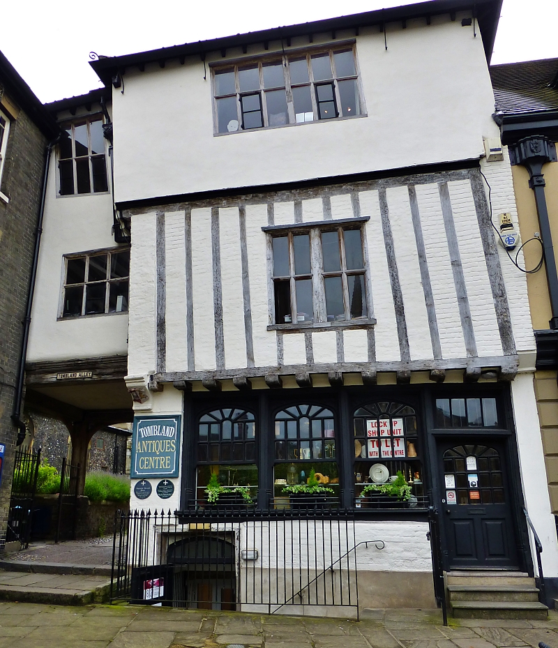 Building along Tombland © essentially-england.com
Elm Hill is one of the best medieval streets in Norwich and has been used in many period dramas. Take in the atmosphere and discover the quaint craft shops, galleries, and tea shops.
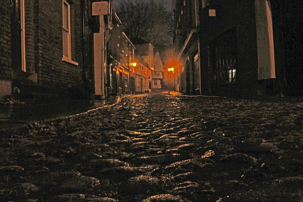 Elm Hill © Juha Agen | Getty Images canva.com
Turn right when Elm Hill meets Princess Street and continue to the fourth of our Norwich 12, The Halls on your right.
These beautiful flint clad halls are the best surviving medieval friary complex in England. They consist of St. Andrew’s Hall, Blackfriars’ Hall, The Crypt, Becket’s Chapel, and The Garth. The City Corporation purchased The Halls from the King during the reformation, thus saving them from damage and destruction. They were used as a common hall for the people, and to this day they can still be hired for concerts, conferences, and weddings.
Fire destroyed the first black Friars’ priory and what is now St. Andrews Hall was the nave of the re-built friary church completed in 1449. The oldest part of The Halls complex is Becket’s Chapel, which dates to 1258 when the original friary was established. The brick vaulted roof Crypt also survived the fire and is dated to 1307. The Garth is a courtyard that was the centrepiece of the friary cloisters.
Leaving The Halls, the walk heads towards the junction between Princess Street and St. Andrews Street, where we turn right. Shortly, on your left is Bridewell Alley, which if you want to visit a small museum that tells the Norwich story will lead you to The Museum of Norwich at the Bridewell.
Continuing
along St. Andrews Street, and after the traffic light, Charing Cross, you come
to another small museum on your left, Strangers Hall. This fascinating museum allows
you to explore a fourteenth century merchant house. They have also made an excellent 30-minute video tour that is available on YouTube.
Stay left at the next fork and walk along St. Benedicts Street past St. Gregorys Church to St. Lawrence’s Church on your righthand side. Opposite the church is a small alleyway between the shops. Turn left here into St. Lawerence Lane. Walk along this lane until a T-junction with Pottergate. Turn right and continue along this cobbled street to another T-junction, where we turn left on to Wellington Lane which runs parallel to the busy A147. The pavement of Wellington Lane runs into a ramp to a concrete bridge that crosses the A147. Cross the bridge to get to the fifth of our Norwich 12, The Cathedral of St. John the Baptist.
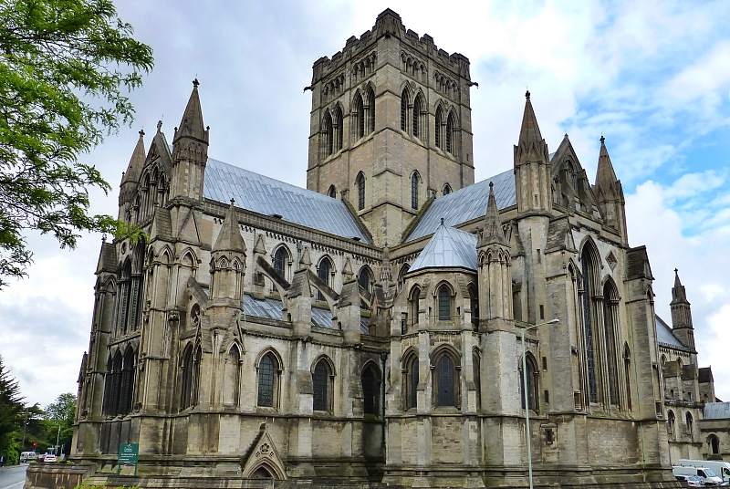 Cathedral of St. John the Baptist © essentially-england.com
Built between 1884 and 1910, the cathedral was a gift to the catholic people of Norwich from the 15th Duke of Norfolk, Henry Fitzalan Howard.
Retrace your footsteps over the concrete bridge and turn right down the ramp to join Upper St. Giles Street. We’re now heading towards the castle quarter, and other sites of our Norwich 12 will appear thick and fast. Walking along Upper St. Giles Street, you will see the tower of The City Hall in the distance. At the T-junction with St. Giles Church on your left, we turn left and then quickly right (almost straight across), into Bethel Street. Walk to the top of Bethel Street to stand in front of St. Peter Mancroft church, which is the largest medieval parish church in Norwich.
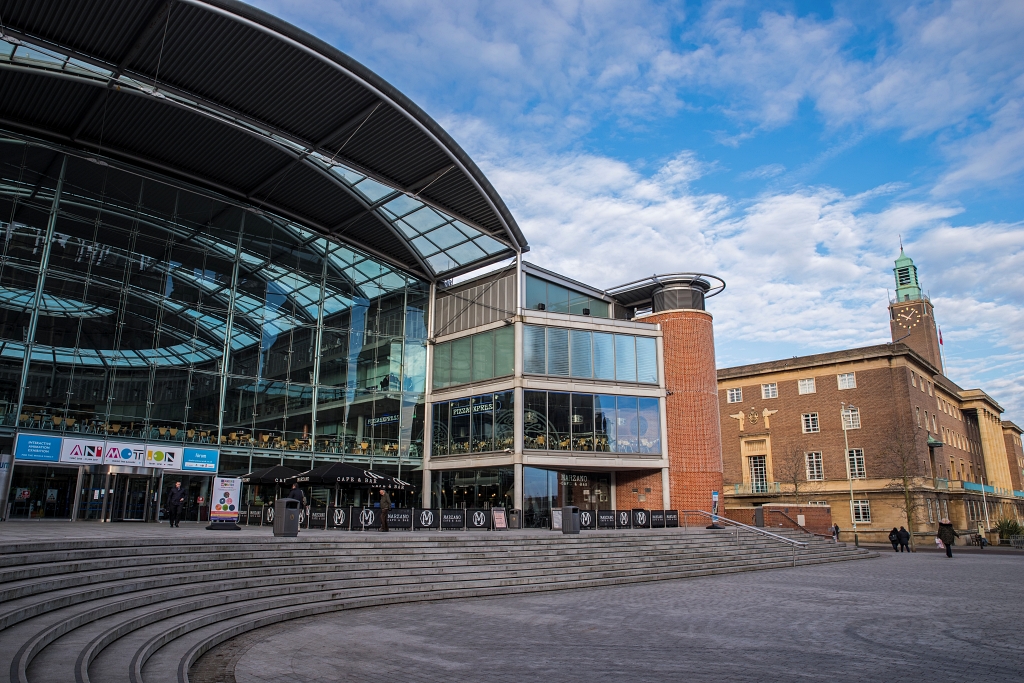 The Forum Next to The City Hall © Chris Dorney | depositphotos.com
Surprisingly, it’s not the church that is our next building of interest, but the very modern building opposite. Completed in 2001, The Forum is the baby of our Norwich 12 and was built to celebrate the millennium. It has a futuristic design and is used as a library and tourist information centre. It has cafés and restaurants, and holds shows and exhibitions.
Walk between The Forum and the church to Theatre Street. On the opposite side of the road is the Georgian Assembly House, another of our Norfolk 12. Completed in 1755, The Assembly House was used for entertainment and has hosted a concert by the composer Franz Listz. Many of its rooms are still in period and now it is used for functions such as exhibitions and weddings.
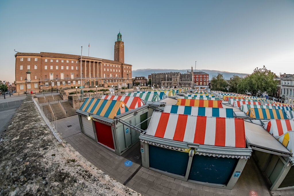 Norwich City Hall and Market © Wirestock | depositphotos.com
Return to the corner of Bethel Street and St Peters Street, with The Forum and St. Peter Mancroft church behind you, you can see three of the Norwich 12 buildings, The City Hall, The Guildhall, and in the distance Norwich Castle sitting on its mound. Also, of interest here, there is Norwich market which was founded in the late eleventh century and the Norwich war memorial. It’s well worth having a wander through the busy market.
Norwich City Hall was built between 1936 and 1938. Its grand entrance with lion statues protecting the staircase, tall pillars, and one of the longest balconies in England overlooks the market square. Inside City Hall, there are art deco and wood panelled rooms.
Walk towards the Guildhall. This stunning stone and flint building was built between 1401 and 1404 to hold all manner of civic assemblies, council meetings and courts. Its grand design reflects the wealth and power of Norwich during medieval times.
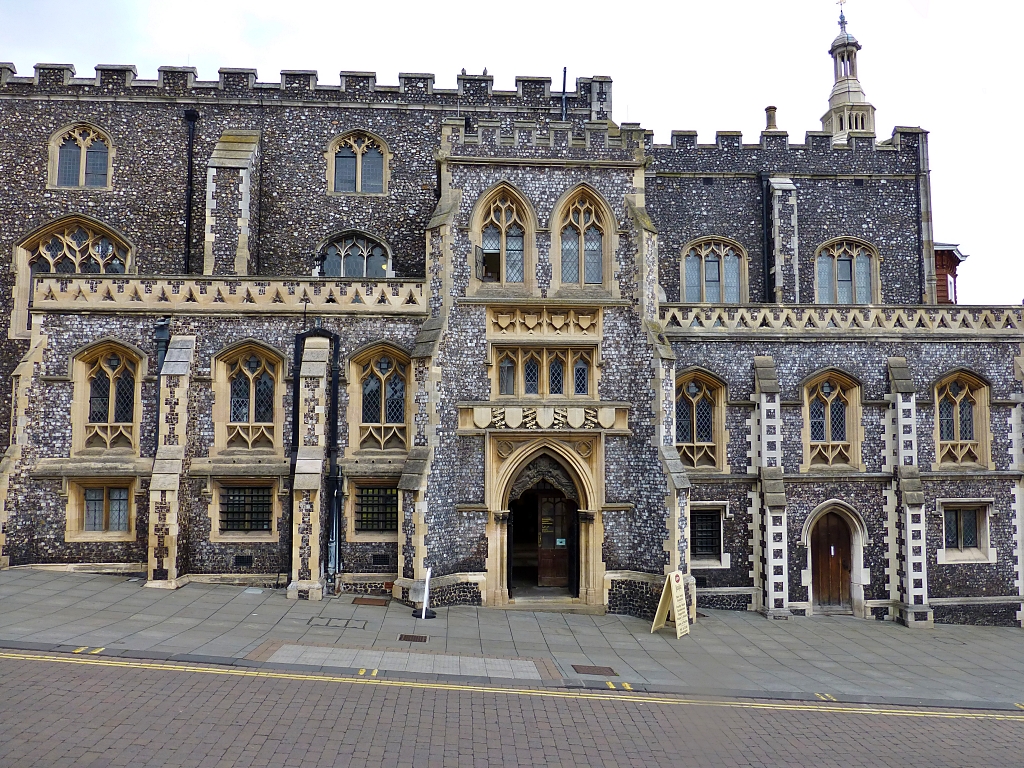 Norwich Guildhall © essentially-england.com
Continue down Gaol Street, to bear left into Exchange Street and then by the Jarolds department store, a quick right on to London Road. Follow London Road, a busy shopping street, and ignore the left turns to Swan Lane and Bedford Street, before taking the right turn in to Opie Street and head for Norwich Castle.
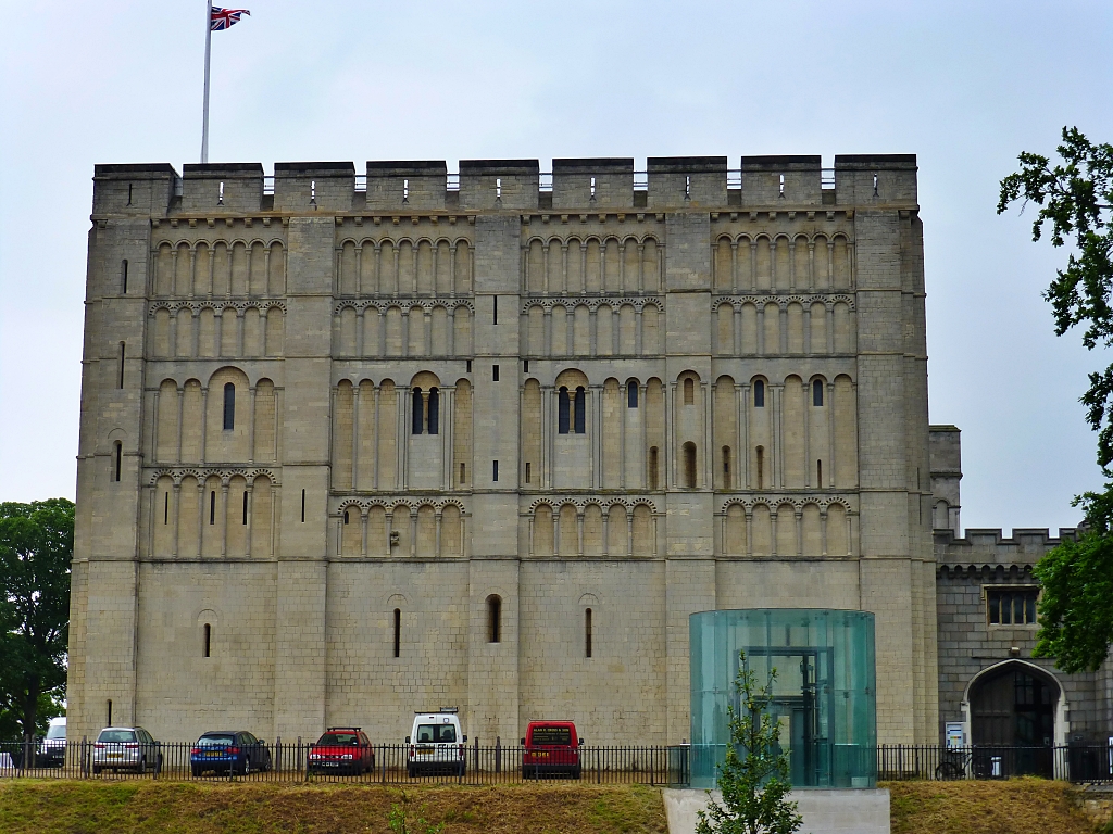 The Oldest Building in the Norwich 12, Norwich Castle © essentially-england.com
All that remains of Norwich Castle is this wonderful Norman keep, which stands upon the tallest motte (or mound) in England. The castle was built as a palace for William the Conqueror and was completed in 1075. For around 500 years, the castle was used as a jail until it was converted into a museum in 1894. It is still a museum and has interesting collections, one being a huge collection of teapots.
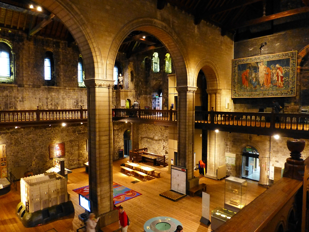 Interior of Norwich Castle © essentially-england.com
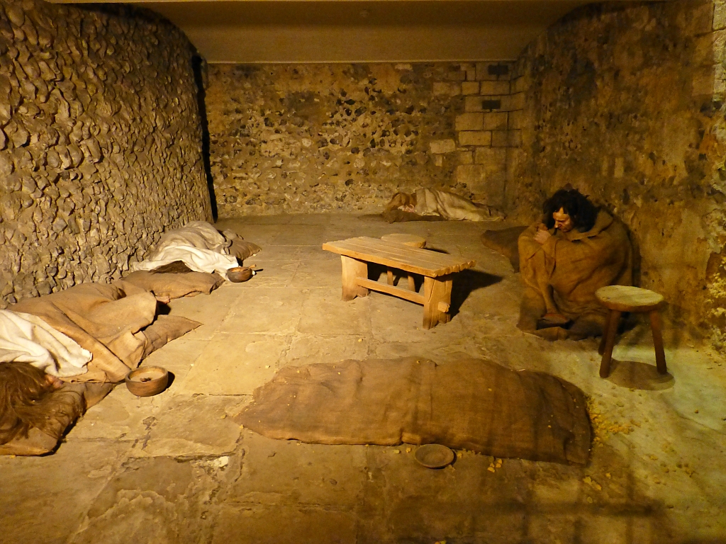 Norwich Castle Dungeon © essentially-england.com
We leave the castle along Castle Meadow. There is about 1 mile left to walk, and we’re heading off towards number 11 of the Norwich 12. Castle Meadow changes into Red Lion Street, and then St. Stephens Street. Shortly after joining St. Stephens Street turn left into Surrey Street.
Along here
on the left stands Surrey House, the elegant Edwardian headquarters of the Aviva/Norwich Union
insurance company. Completed in 1912, Surrey House was to be a “splendid
and functional office space” yet also demonstrate the strength of the company.
It houses Marble Hall, which is decorated with 15 different types of marble and
contains many unusual items.
Continue along Surrey Street. At the crossroads with All Saints Green continue straight until a small left turn into Surrey Grove. We’re heading towards a multistorey car park on a small, cobbled road. At the John Lewis car park building turn left and soon turn right to join the main entrance/exit road on the other side of the car park.
Turn right and quickly left onto Thorn Lane. Walk along Thorn Lane until the T-junction with Rouen Road, turn right, then shortly turn left into St. Julians Alley. By the quaint St. Julians church, the road turns into a pedestrian zone. Follow this path until you come face to face with our last building in the Norwich 12, Dragon Hall.
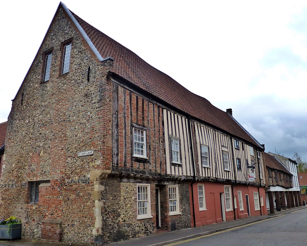 Dragon Hall © essentially-england.com
This long, timber-framed medieval building belonged to a rich merchant and was used as a place to trade. It was completed in 1430 and gets its name from a dragon carved in one of the wooden roof beams. Dragon Hall is now home to the National Centre for Writing and a tourist attraction that can be used for weddings, functions, and shows. Here is a nice YouTube video about the first owner, Robert Toppes, that gives an insight about Dragon Hall and how it was used.
Take the cobbled path opposite that goes through Dragon Hall, where there is a nice doorway on your left. Old Barge Yard takes us back to the riverside for the remainder of the walk back to the train station. Cross the River Wensum on the Lady Julian Bridge to a plaza area, where you can join the riverside path back to the bridge outside the station.
Are You Planning to Visit Norfolk?
Where You Could Stay
We love this part of the country and were really sad when the holiday cottage we liked so much in Blakeney became a private home. However, it did make us research the area again and try something new - Honey Barrel Cottage in Stiffkey. Again, we were close to the salt marshes and could explore new parts of the north Norfolk coast path. So my selection of holiday cottages are spread along our favourite parts...
To see other holiday cottages in Norfolk click here. Or check out holiday cottages in other parts of England by clicking here.
Or you could try a family orientated holiday resort in Lincolnshire as there's plenty of choice...
If you need to find a hotel, then try one of these search platforms...
What You Could See and Do
Are you feeling in need of a holiday yet? Here are a few more pages that might give you ideas...
- See the seals at Blakeney Point
- Visit Castle Acre and discover its Priory and Norman castle
- Go crabbing at Cromer or Wells-next-the-Sea
- Walk around the salt marshes between Stiffkey, Blakeney and Cley-next-the-Sea and try to identify the different birds
- Take a walk around Sheringham Park and enjoy the colours of the rhododendron bushes
- Or you could try our Things to do in Norfolk page...
What a great day out we had exploring the historic buildings of Norwich. We hope you’ve enjoyed our account of the varied buildings of the Norwich 12.
For more holiday or day out ideas return from norwich 12 walk page to the Norfolk page.
