Exploring Roman Piercebridge
We first came across Piercebridge while driving home from a break in Northumberland. As we passed through a pretty village beside the River Tees, we spotted a brown “Roman Bridge” road sign. We looked at one another and simultaneously said “we need to see that.” You can read the "results" of that impromptu decision on our Piercebridge Roman Bridge page. However, shortly after our return we watched an old Time Team program on TV where their archaeological team investigated Piercebridge Roman Fort. We had no idea there were visible ruins of the Roman fort, so six months later, on another trip north, we purposely stopped to explore Roman Piercebridge in a bit more detail.
We were more prepared for our return visit to Piercebridge and I had even mapped out a short walk around the village which I’ve called the Piercebridge Promenade. It’s only 1.1 miles long and visits the Roman Bridge and Fort. The start point is the Roman Bridge car park next to The George Coaching Inn on the B6275 road that runs through the village. And as luck has it, this autumnal day was dry, so we were ready to go exploring Roman Piercebridge…
If you want to follow our walking route and use Komoot.com, then search for the route on your mobile device. For those that use GPS devices, click on “Discover more info about this tour” to download the gpx file.
Introduction
Dere Street is the name commonly given to the main Roman road from York to the Firth of Forth in Scotland. The road traversed very demanding landscape and included several tough river crossings. The road was used to get men and supplies up to the most northern reaches of the Roman Empire and due to its importance, the Romans built a series of forts to secure it.
One of the largest rivers Dere Street had to cross was the River Tees and the crossing point is now the small village of Piercebridge. It is believed that in Roman times this settlement was called Morbium.
Most of the Roman fort lies under the village green and surrounding houses, but behind one row of houses some remains have been excavated and can be explored on foot. There are information boards explaining what is on show.
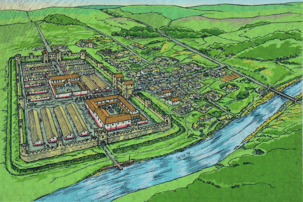 Artists Impression of Piercebridge Roman Fort, Bridge, and Dere Street (from English Heritage information board)
© essentially-england.com
Exploring Roman Piercebridge
In the corner of the car park, an English Heritage information board gives a little background information about the Roman bridge and what remains now. In its day it was probably a very impressive bridge.
Climb the stone wall stile and follow the path round to the bridge site. The path can get a bit muddy after wet weather but is easy to follow as there are fences and hedging either side guiding you the correct way.
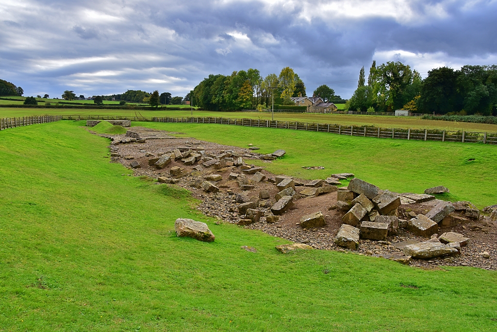 The Remains of Piercebridge Roman Bridge © essentially-england.com
Piercebridge Roman Bridge was built over 1800 years ago and was the second River Tees crossing the Romans built here. The first bridge was made of wood and was about 200 metres west of this bridge. It got washed away in around the year 150AD.
It's quite amazing how far the River Tees has moved in this time as the large southern abutment is nowhere near the river now!
We have more information on the Roman Bridge here.
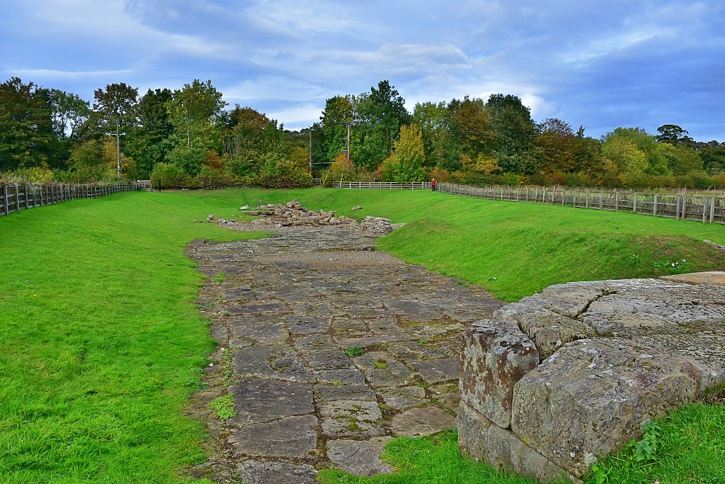 The South Abutment and Flagstones at Piercebridge Roman Bridge © essentially-england.com
Retrace the route back to the car park and follow the pavement past the pub, across the River Tees on a more modern stone bridge, to St. Mary’s Church opposite the village green. On the way there are several lovely old, colourful buildings to admire as well as great views of the river from the bridge.
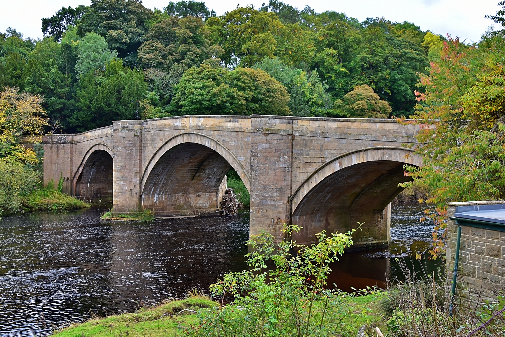 The River Tees in Piercebridge © essentially-england.com
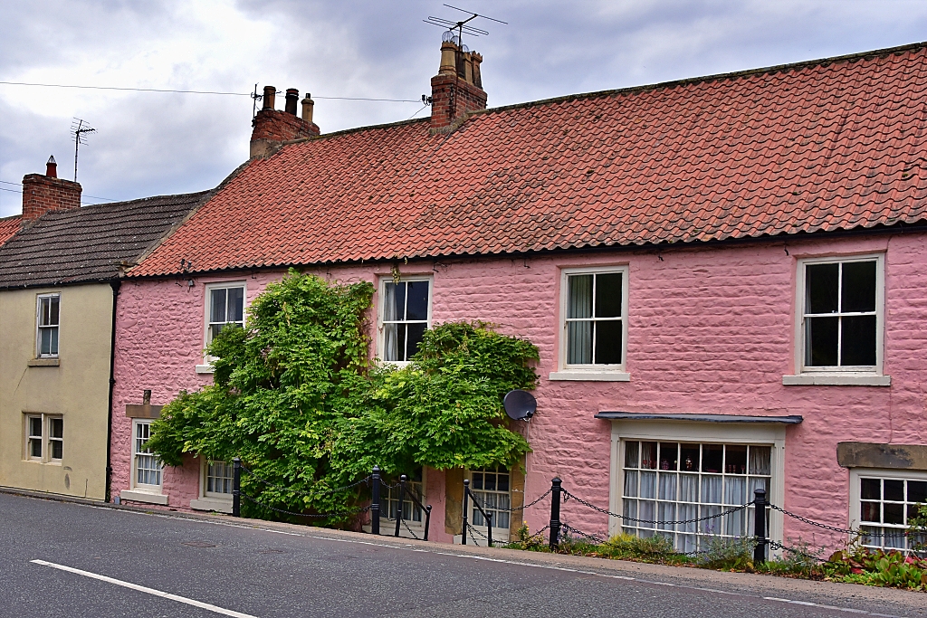 Cheerful Houses in Piercebridge © essentially-england.com
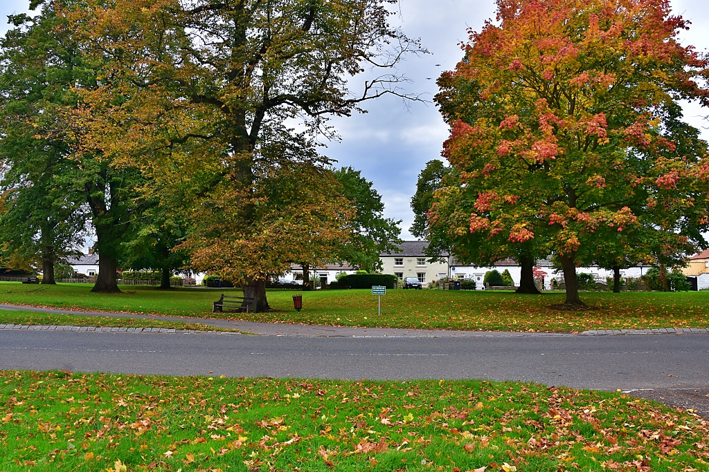 Piercebridge Village Green © essentially-england.com
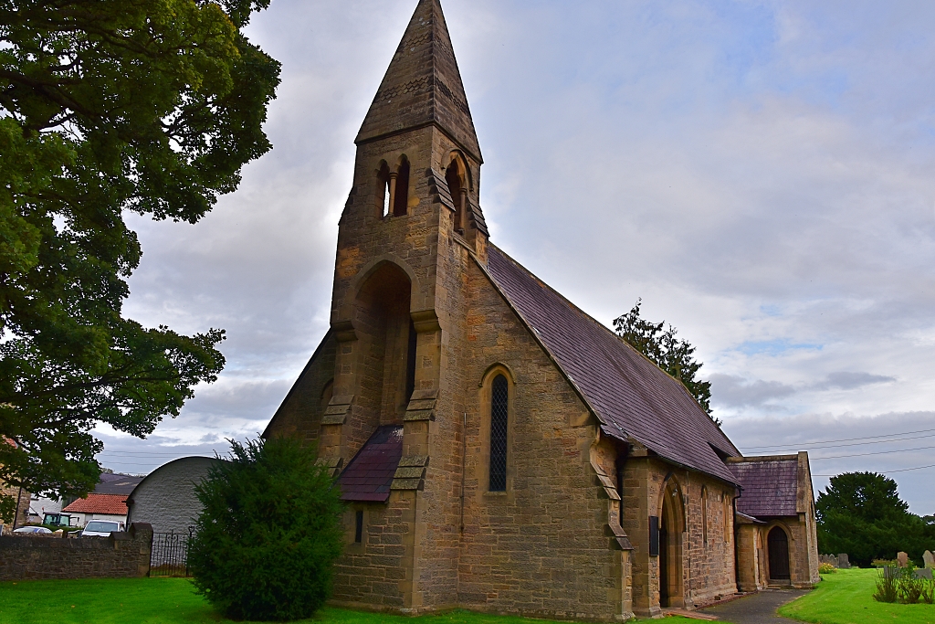 St Mary's Church in Piercebridge © essentially-england.com
After looking around the church, backtrack about 20 metres to find a gap between the houses that leads to the Roman fort. And low and behold, guess what stands there; a brown “Roman Fort” sign! I wonder why we didn’t see this when we drove through the first time.
Walk between the houses, through a gate and into the Roman fort excavation.
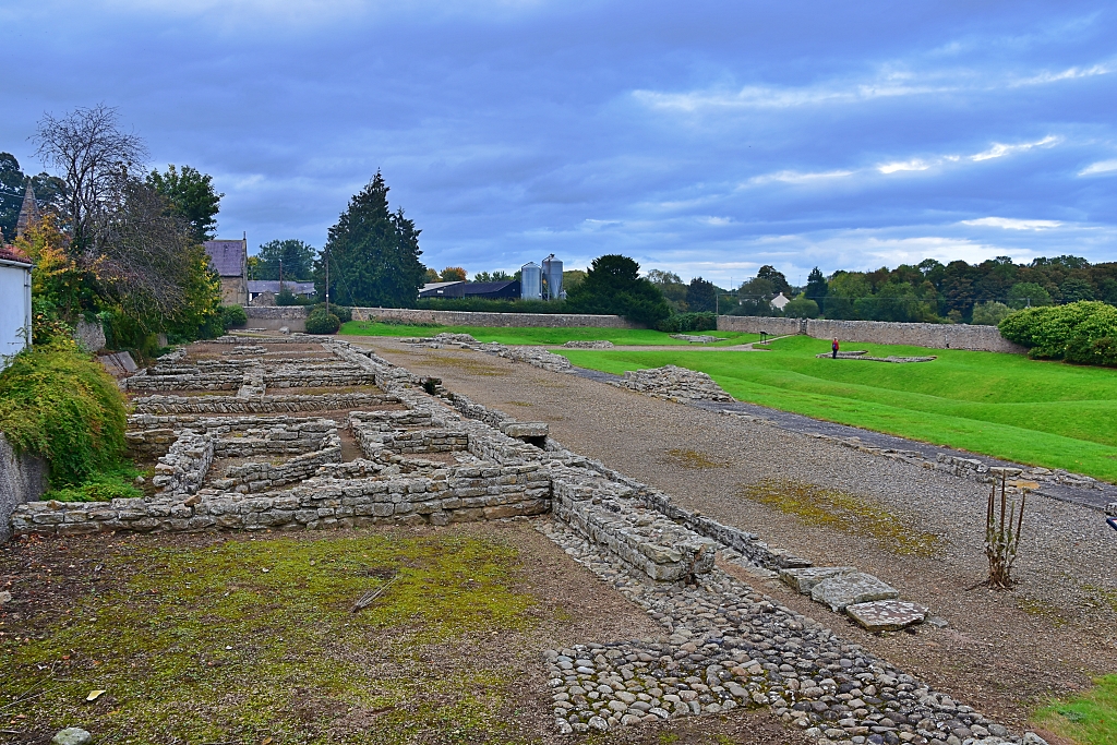 Piercebridge Roman Fort Excavation Site © essentially-england.com
This fort was built around the year 260AD and was occupied until after the year 400AD. It was rectangular in shape with protective stone wall and four main gates, the largest facing east towards Dere Street. Inside the fort would have been the headquarters building, commandant’s house, barracks, stables, a hospital, granaries, workshops, and a bath house.
Ditches and pits filled with sharpened wooden
stakes to injure or kill unsuspecting intruders would have lined the outside of the walls.
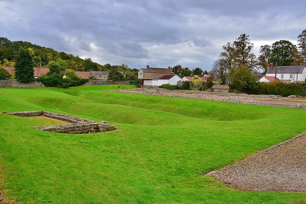 Roman Fort Excavation from the East Gate
 © essentially-england.com
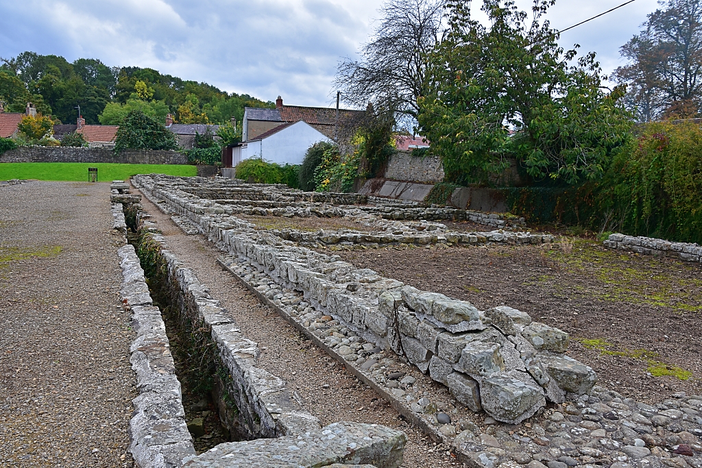 Wing of Courtyard Building
 © essentially-england.com
After viewing this lovely little excavation, leave the site by taking the footpath between the two towers of the east gate and through the gate in the wall. Directly in front is a green field which once was the civilian settlement, or vicus, where traders and merchants lived and sold local goods and services to the Romans. It doesn’t look much from here, but after really dry weather and from above the road and building layout shows up in the soil.
Turning right on the path, continue straight to return to the road and retrace back to the car park.
I’m really pleased that we returned and explored more of the Roman story of Piercebridge, as without the fort and the bridge, Piercebridge might not exist at all. Stopping off for a wander also made a lovely short break from our journey and to stretch our legs.
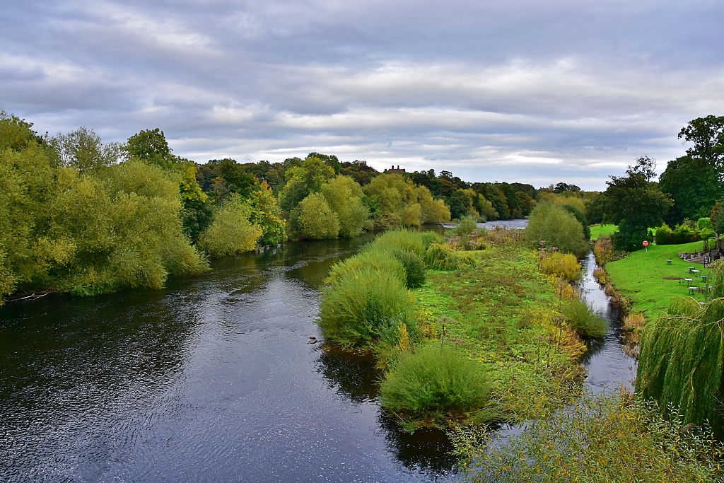 The River Tees Flowing Through Piercebridge © essentially-england.com
County Durham Holiday Cottages
County Durham, or more often just plain old Durham, is a county with a rich history and stunning natural landscapes. It makes for a great holiday or short break destination. There is the city of Durham with its castle and cathedral, a North Sea coastline, and hills and dales to explore.
To browse holiday cottages in other parts of England click here, or you could try our Booking.com search box.
If you have enjoyed reading about our short meander through Roman Piercebridge and would like to explore other areas of England, then please return to our home page.

